  |
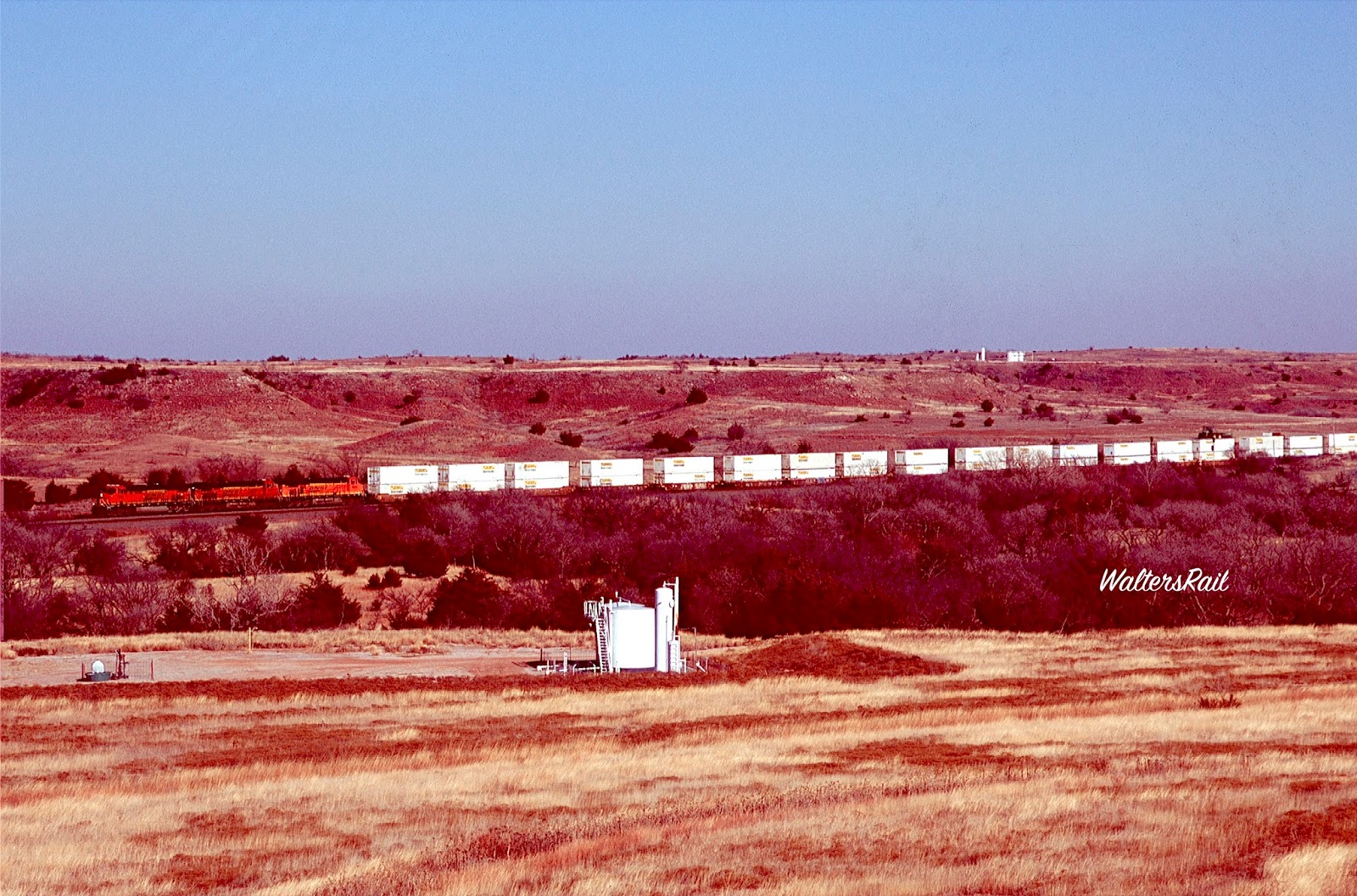
| Westbound Stacks Climbing Out of The Cimarron River Valley
Oklahoma railroads, like the state itself, sit at crossroads. The Kansas City Southern over Rich Mountain is located squarely in the South. The BNSF Red Rock Subdivision near the Kansas border, on the other hand, shouts "Midwest!" between rows of corn and soy beans. At Curtis Hill, where the BNSF Chicago-to-Los Angeles Transcon crosses the Cimarron River, one has entered the West. You might even say that Curtis Hill is, "Where the West Begins."
For centuries, the Cimarron River has gouged mesas from the gypsum-rich soil of northwestern Oklahoma. Because the hill-top minerals are lighter in color than the surrounding red clay, the locals call these formations the "Gloss Mountains." For most of the past thousand years, this striking landscape of red clay and sandstone, of cap rock mesas, buttes and escarpments, was relatively undisturbed by human activity. All that changed with the opening of northern Oklahoma Territory's Cherokee Strip to European settlement and the arrival of the railroad. |
 |
| BNSF 7812 West Approaching the Quinlan Bridge in 2013
The original mainline of the Atcihison, Topeka and Santa Fe followed the wagon route of the Santa Fe trail across central Kansas and southeastern Colorado to Raton Pass, a gap on the Colorado/New Mexico border through a monstrous lava flow from long extinct volcanoes. The ruling grade was three percent on both slopes, a punishing approach that the railroad selected mainly to keep the rival Rio Grande from gaining a through-route south of Denver. The Santa Fe knew, however, that Raton Pass would never support heavy freight traffic, so the railroad almost immediately formulated plans to build a more southerly route -- similar to the so-called "Cimarron Cut-off" of the Santa Fe Trail -- to bypass completely the lava flows.
|
 |
Westbound Stacks Passing Two of the Hundreds of Wells Dotting Curtis Hill
Westbound Power Passing Eastbound Manifest on Approach to Summit of Curtis Hill, With Drilling Rig in Background
Although the South Kansas Railroad laid rail over Curtis Hill in 1887, there was little traffic until the rest of the Belen Cut-off was finished in 1908. Tonnage increased even more after workers built track through the Flint Hills of Kansas, linking the original Santa Fe mainline at Elinor to Belen, New Mexico and points west -- via Curtis Hill.
|
 |
| Westbound Stacks Beginning Climb out of Cimarron River Valley, With Sand Dunes in Background |
 |
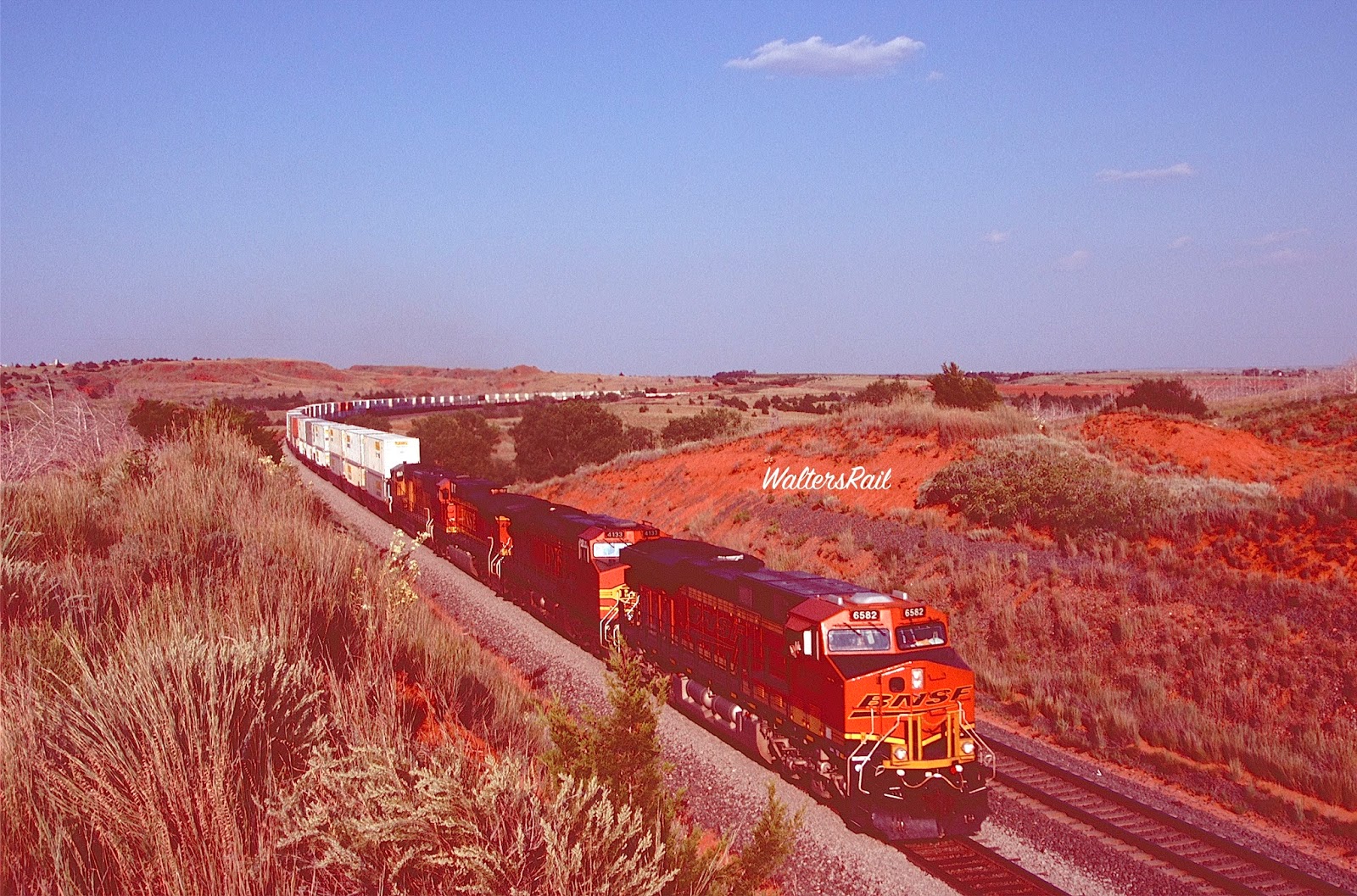
| BNSF 6582 West on Final Approach to the Summit -- Notice the Cross in Upper Left, an Echo of Tehachapi Loop
During the steam era, almost all westbounds received helpers for the twenty-mile climb to the summit. The original mainline was so winding, the curves so narrow, that the railroad rebuilt the line in the 1940's. Remnants of the original line are still visible.
Even after realignment, the hill was a bottleneck, especially as manifest freights grew longer and heavier after World War II. From Waynoka, the line heads west down a 0.6 percent slope into the Cimarron River Valley, and thereafter climbs three miles of 0.9 percent grade to Belva, site of a two-mile flat stretch (and former siding). The tracks then struggle up eight miles of 1.0 percent to the summit at Curtis. In 13 miles, elevation rises 563 feet. |
 |
| Eastbound Stacks Flying Downgrade, With the Summit of Curtis Hill Above and to the Right of BNSF 4785
Before the line was double-tracked in the mid-1990's, westbounds would often pile up at the bottom of the hill, waiting at Heman, while a heavy train struggled the last few miles below Curtis. To facilitate moving meets, and to allow more than one train to wait in a siding, the Belva and Quinlan sidings were twice as long as normal (11,804 and 10,329 feet), with intermediate block signals in the middle.
Railfanning the hill before double-track often consisted of catching a westbound manifest at the bottom and leisurely following the hard-surfaced county road to the top, grabbing shots at the two overpasses in the middle of the grade and wherever else one desired. Ascending trains often slowed to less than ten miles per hour. |
 |
| Westbound Stacks Climbing out of Cimarron River Valley, with Little Sahara State Park in Background |
 |
| Eastbound at Dusk at Top of Curtis Hill, Preparing to Descend |
 |
| Westbound Stacks Approaching Belva
As the Santa Fe's traffic shifted from bulk freight to time-sensitive merchandise, trailers and double-stacks began to monopolize the hill. These light, well-powered trains raced upgrade; chasing became almost impossible. Nonetheless, Curtis Hill was still a bottleneck. Even the highest priority westbound traffic sometimes sat at Heman (at the bottom of the hill), waiting impatiently for a slow manifest to crawl to the top.
|
 |
| Westbound Stacks in Cimarron River Valley -- July 2014
From 1970 to the mid-1990's, traffic at Curtis Hill increased from about 24 trains per day to more than 60. Capacity was "maxed out," so the Santa Fe double-tracked the entire hill in 1995 on the eve of its merger with Burlington Northern. The project was astounding, in part because it was completed with relatively few men, most of whom piloted gigantic earth-movers -- yellow monsters gouging red clay from hills and depositing the rubble as fill in the steep valleys. When the project was completed, the railroad was changed forever. Where before the single-track line had edged through cuts barely wider than the trains, the double-tracks now ran long and wide like an interstate highway; today well-powered trains race up and down the hill at interstate speeds.
|
 |
| BNSF 6545 East Leads Z-RICWSP Through Heman in June 2012 |
 |
| Eastbound Stacks at Dusk
When I was photographing Curtis Hill in 1995, an elderly couple in an old Buick stopped on the bridge above what used to be the west end of Quinlan siding. Below in the cut, construction crews were busy with the double-tracking project. Yellow earth movers growled and roared. Each train approaching from east or west stopped at the bottom or top of the hill to receive radio permission from the foreman to pass the construction.
|
 |
| Eastbound Trailers at Quinlan |
 |
| Westbound Trailers Approaching Curtis at Top of Grade
The old man stopped his ancient vehicle next to me. His wife pushed a wrinkled face out the open window and, with no prompting whatever, told how the Santa Fe had hired a large number of female employees during the Second World War. She had been one of them, an operator at Waynoka, working the third trick. She recalled one night when a manifest was switching cars in the parking yard north of the depot while she was standing on the brick platform beside the tracks, waiting for the arrival of a passenger train.
Out of the darkness came a voice like none she had heard before, saying, "For the love of God, Lady, help me! Please!" A locomotive fireman had somehow tripped in the darkness, and his arm had been cut off by a moving box car.
|
 |
| Westbound Stacks
As the old woman was telling this story, a second vehicle stopped on the bridge in the opposite lane. The car contained a younger couple who might have been (but were not) the children of the older pair. Soon the conversation turned to the double-tracking project and the impending replacement of the overpass. Yellow earthmovers continued to growl in the cut. Container trains inched slowly past. No other vehicle came along the road to interrupt the conversation.
|
 |
An eastbound stack train approaches Quinlan in July 2010. The cottonwood trees on the left have grown in the past 40 years, obscuring a number of once enticing photo locations.
|
 |
| An Eastbound Z Train (Mostly UPS Trailers) Roars Downgrade as Westbound Stacks Labor up the Hill at the Big Cut at Quinlan
A logical place to begin photographing Curtis Hill is Waynoka, now down to less than 900 hardy folk who spend much of their time at the single convenience store and gas station. When Waynoka was a crew change point, the on-duty operator was a good source of train information. Since 1986, however, crews have been blowing through town without stopping. Around the time of the BN/ATSF merger, the Waynoka Subdivision disappeared into the Panhandle Subdivision, which extends from Wellington, Kansas, to Amarillo, Texas -- 313 miles!
|
 |
| A High Priority Z Train Roars East into the Cimarron River Valley |
 |
A westbound Q Train is beginning the climb to Belva. Mount Heman is in the background. At the rear of the train was the west end of the old Heman siding.
|
 |
| Another Q Train in the Cimarron River Valley
If you are heading to Curtis Hill, take water and a cell phone, because there is no store or public telephone on the hill. The small convenience store at Quinlan has been closed about five years, and it does not look like anyone plans to reopen it.
The wind almost always blows in northwestern Oklahoma, layering everything, including cameras, with red dust, so keep your equipment protected. During warm months (April through October), rattlesnakes are active and numerous -- so numerous that Waynoka holds an annual Rattlesnake Hunt each year.
During the double-track project, workers inadvertently unearthed a den of over one hundred rattlers near Curtis. Construction stopped until the snakes were removed, not so much out of ecological concerns but rather from fear -- which I understand. I have almost stepped on rattlesnakes several times, which is why I now take my dog Bear (aka Mighty Dog) whenever I railfan in the West. He can smell snakes hundreds of yards away and always gives advance warning.
You should also watch out for chiggers -- nasty insects that you cannot see but will bite you all over your body and leave you itching for weeks. If you are unfamiliar with chiggers, you will only forget the insect spray once.
|
 |
| Westbound Grainer Led By Two Extinct BNSF Paint Schemes in 2014! |
 |
| Eastbound Stacks at Belva -- June 2012
If you are hiking Cutis Hill in summer (which extends through the end of September), remember that you are below the Mason-Dixon line. The heat will be intense. I recommend a hat, sunscreen, sun glasses and plenty of water.
On the other hand, if you are hiking in winter, you are standing on the incline that leads to the Front Range, so have warm clothing handy. The winter temperature in this part of the world can drop from sixty to thirty degrees faster than you can believe. If you are out in January and you see black clouds to the northwest and the wind suddenly grows calm, head for your vehicle. A "Blue Norther" is on the way.
|
 |
| Aftermath of a Blue Norther -- December 2015 |
 |
| Westbound Manifest and Adolescent Bulls
According to my unofficial calculations, it always snows at Curtis Hill on Monday or Tuesday. Since I live about 150 miles away and must work for a living, that means by the time I can reach the tracks on the weekend, most or all of the snow has melted. In this particular case, there was some white stuff remaining. The adolescent bulls seemed to think that I could provide either food or warmth. I could provide neither. In any event, they stood beside me for several hours while I took images of the passing trains. Question: who was more insane?
|
 |
| BNSF 4026 West Struggling Into the Grade
One other word of caution: Avoid Curtis Hill during the Thanksgiving Holidays. This is deer season in Oklahoma. Much of the land in this area is leased to hunters, including many who fly in from across the country. If you wander off the public roads, you will likely find yourself staring down a barrel. It happened to me, and I do not recommend it.
|
 |
| BNSF 5160 West
Because of the sand dunes along the Cimarron River, no road follows the mainline southwest out of town. Thus, reaching the railroad bridge across the river is very difficult, and I do not recommend it. The best photographic location is south of the bridge on the east side of the river, but to reach this spot, one must fight one's way through a forest of Eastern Red Cedars that have grown so close together that, in places, one must crawl along the ground. If that were not enough, past the cedars is a cane forest about 25 feet high. The only way through this thicket is to push the canes out of the way one at a time. Some will snap back and hit one in the face. At this moment, one will wonder if shots of the bridge are worth the effort. Now the canes part, and the river appears. So even if one feels the effort misplaced, one will go ahead and take the photographs.
|
 |
| Westbound Stacks Crossing Cimarron River, With Cane Forest in Foreground
To reach the west side of the river where the Transcon runs through a wide valley, take US Highway 281 south out of Waynoka, cross the Cimarron highway bridge and continue about 1.5 miles south to a county road where you will see a sign for Belva. Turn west and go past an abandoned country school until you come to a small wooden house on the north side of the road, its yard littered with trucks and rusted oil field equipment. To your northwest you will see, a couple of hundred yards away, a gypsum-topped bluff (one of the Gloss Mountains) with the double track mainline at its base. Take the dirt road north under the tracks and up a small hill. On the far side, you will see Mount Heman, a solitary gypsum bluff that gives the surrounding 7,000 acre ranch its name.
|
 |
| A Westbound Grainer Struggles Near the Top of the Grade, While Westbound Stacks Run Around It
To the west you will see a broad mesa running north to south, which can be climbed if you are adventurous and can also be approached on oilfield roads from the west if you have a high clearance vehicle. From the top, the river valley and bluffs open before you. Several of the images in this post were taken from this location.
|
 |
| Westbound Stacks Photographed From the Mesa West of the River, With Sand Dunes in Background
As an added bonus, beyond the tracks to the east you will see the Little Sahara State Park, a remnant of sand dunes that once stretched along the Cimarron River for hundreds of miles. The Transcon does not run through active dunes, instead reaching Waynoka through an area of sand now stabilized with buffalo grass and dwarf oaks. When the sun is low in the west, the dunes look surreal, as though part of an alien landscape.
|
 |
| Westbound Trailers
The Z train immediately above is leaning into a curve that, according to local maintenance crews, is the longest on the railroad. This is the beginning of the climb to Curtis. Block signals here bear the legend "G" below the milepost sign, indicating that, with dispatcher permission, trains can pass by a red board because of the steep grade.
|
 |
| In this image, eastbound stacks are on the same curve as above. Behind the train is the gypsum-topped mesa from which the photograph above was taken. Returning to the hard-surfaced county road opens multiple shots of trains in both directions running beneath the bluff. I do not recommend jumping the fence because of the adolescent bulls grazing in the pasture, as one of the images above shows. From the roadside, one may obtain excellent winter pictures because the sun is low in the southern sky. |
 |
| BNSF 4184 West at Belva
Continuing west will bring you to the old Belva siding. Where the tracks diverge from the road, a narrow trail on the south side runs about two miles along the tracks before dead-ending and is used by railroad crews and local ranchers. Near the end, the tracks curve northwest through a large cut. Excellent afternoon shots of both east and westbound traffic may be taken in summer from the west side of the cut. The hike to the top is somewhat strenuous but worth it.
|
 |
| This Westbound Manifest Has Passed Belva and is Struggling Into the Grade. Eight Miles Ahead Lies the Summit. |
 |
| Same Location, With West End of Old Belva Passing Siding at Rear of Train
About six railroad miles up the hill sits the semi-ghost town of Quinlan. Before the completion of double-tracking, the passing siding diverged here from the mainline, following the route of the original line up the grade. Prior to 1995, one could take a shot from the Quinlan Bridge, which the tracks run beneath in a large cut, looking east where the two tracks split. In those days, a highlight of any trip to Curtis Hill was to catch trains on both mainline and passing siding, one curving northeast through a deep and narrow cut, the other curving southwest around the red bluffs.
|
 |
| Eastbound Stacks Approaching Quinlan Bridge |
 |
| Westbound Rolling Beneath Quinlan Bridge Toward Sunset
Years ago, west of Quinlan Bridge, one could follow the railroad service road along the original grade. That route is impassable now, and the railfan must hike upgrade around another huge curve toward the summit at Curtis. (The automatic spell-checker keeps changing "railfan" to "mailman," and I do not know how to turn it off.)
|
 |
| Westbound Approaching Quinlan Bridge at Sunrise -- June 2010. |
 |
| Westbound Stacks with Quinlan Bridge in Background
Several places around Curtis Hill will help sustain life, although perhaps not in the style to which one is accustomed. Waynoka has one cafe, one convenience store and two poorly maintained motels near Little Sahara State Park -- suited for those wishing to sleep near sand and dune buggies. About 20 miles west on US Highway 412 lies Woodward, population 12,500, boasting many good motels, restaurants and convenience stores. Mooreland is located halfway between Waynoka and Woodward, with one modest motel and restaurant. Twenty miles northwest of Waynoka is the small college town of Alva, which features decent accommodations and restaurants but is a long drive from Curtis Hill. For my money, Woodard is your best bet.
|
 |
| BNSF 6582 West at Top of Hill
Curtis Hill is not as spectacular as the ex-BN line hugging the Sangre de Cristos in southern Colorado, or New Mexico's often-photographed former Santa Fe mainline winding through mountain passes and deserts. For those living in the East, Midwest or Southeast, on the other hand, this location offers much. Traffic levels match those in Abo Canyon. And Curtis Hill is 500 miles closer, and no one will arrest you. I've photographed the hill so many times in the past 40-plus years that I've lost count. If you have the chance, you should check out the heavy traffic and rugged, red landscape -- the place where the West begins.
|
 |
| At Sunset, an Eastbounder Begins Its Descent of the Hill -- January 2010 |
wr
very good Paul. At last, I get to see what Curtis Hill can provide and a narrative that explains the action.
ReplyDelete