[This post gives an overview of some of the many canyons in the western United States traversed by railroads. For those wanting more information, each section heading contains a link to a detailed discussion in this blog about each specific canyon.]
If you live long enough, you accumulate things. Before my father passed, he and my mother sold their house of many years and moved to a smaller cottage. I helped them sort through the detritus of 60-plus years of marriage, which was like sleeping on a mattress made of your old shirts. We spent hours, days, weeks, rummaging through unimaginable piles of things acquired at times that no one could remember, that no one wanted to remember. I found a barbecue grill in a box in the garage. The box had never been opened. My father did not remember purchasing it.
I found a motor scooter that my father had acquired when he was almost 90 (he died at 97), intending to ride it to work. Of course, he never rode it. As far as I know, he never started it.
In my own life, I have accumulated boxes and boxes of railroad slides. I realize that others have acquired more images, superior images, but I am still amazed at the sheer number that almost completely fill one room of my house. I feel like a trauma surgeon who keeps in jars of formaldehyde the various body parts he has amputated during his career -- a leg here, an arm there -- and why do we keep doing this year after year after year? If we live long enough, we become prisoners of ourselves, doomed to repeat until death the patterns of behavior imprinted upon us at birth. Unlike electro-magnetic waves, however, these behavior patterns grow stronger as they recede from the source. Eventually, if we reach a certain undefined "magic" age, we become caricatures. It is very possible that I may perish when my slide boxes lose their footings, like slabs of granite on a sheer canyon wall, and tumble down on top of me -- a landslide of trains.
Anyway, with that image of canyons, I present images of a few in the western United States, acquired over several years of driving, hiking, climbing and photographing.
Little Canyon of the Arbuckles
The Little Canyon of the Arbuckles (generally called just "Little Canyon") is aptly named. Only about one mile long, it (actually the Washita River) carves a tiny gap through the equally tiny Arbuckle Mountains of south-central Oklahoma. The Arbuckles are the remnants of a once formidable mountain range. All that is left today are the tops of the tallest peaks, now worn down through millions of years of erosion to little more than glorified hills. Still, the area presents photo opportunities, provided one is willing to hike, then climb some moderately steep rock outcroppings. (The global coordinates for this location are 34°27'14.3"N 97°06'04.1"W.)
If you ever intend to visit this area, be warned that the local residents are wary of outsiders. Thus, you should park your vehicle in an inconspicuous location, preferably behind some bushes. Otherwise, you may meet the same fate that I once met. At the end of the hike from the canyon to my truck, I was met by two men carrying shotguns, who thought that I had been hunting on their property. When I told them I was a photographer, they looked skeptical, so I let them search my back-pack and tri-pod, and they then seemed to believe me. Even if you are not accosted by firearms, be aware that vehicles are often stolen in rural parts of my home state. As I said, try to hide yours.
 |
| A southbound Z-train is entering Little Canyon from the north. The red waters of the Washita River are below the tracks. |
 |
| A southbound Z-train in the middle of Little Canyon. |
 |
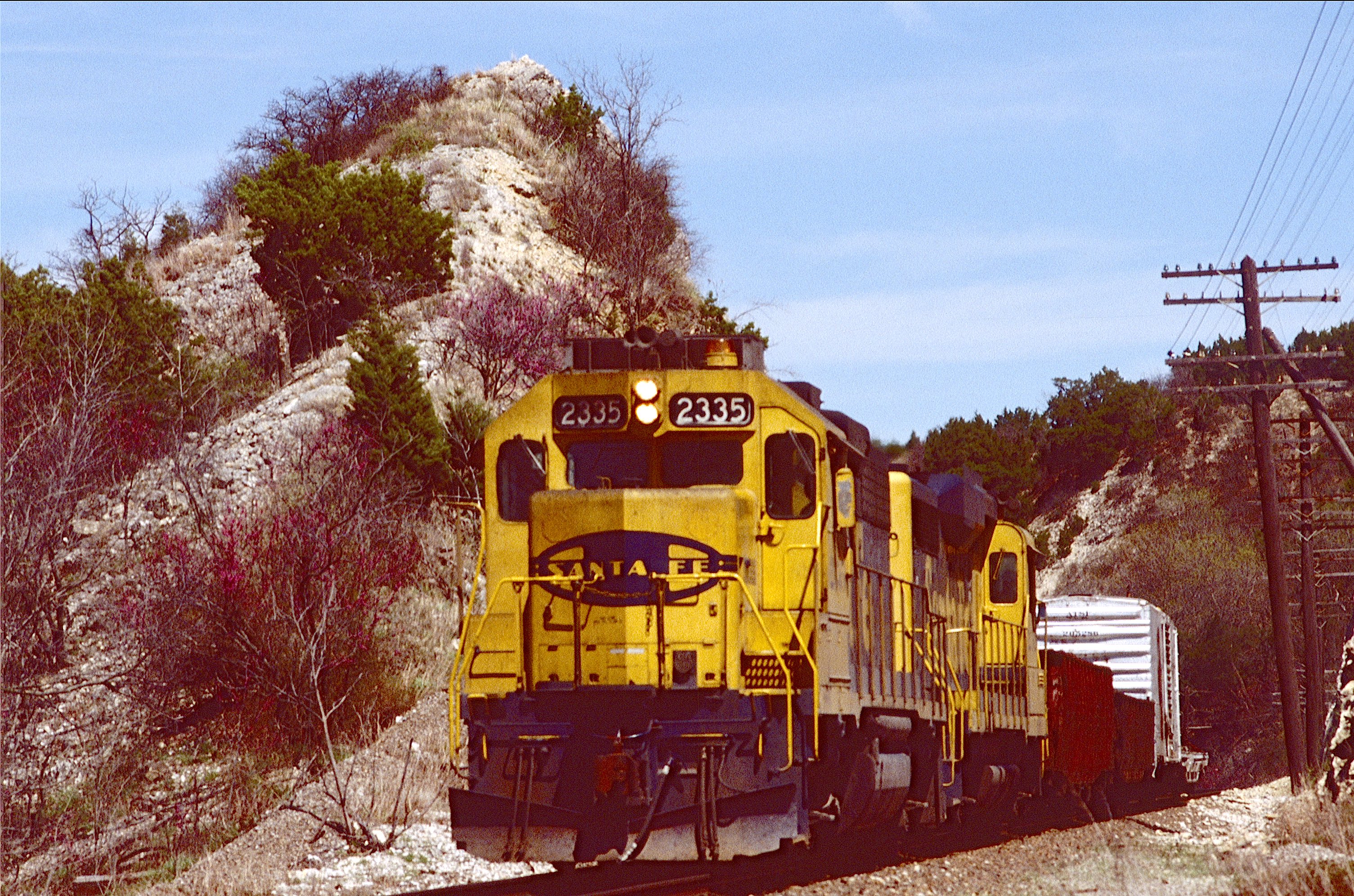
| A southbound AT&SF manifest in Little Canyon. |
 |
| An AT&SF manifest entering Little Canyon from the south. |
 |
| A Santa Fe freight exiting the southern mouth of Little Canyon. |
Big Canyon of the Arbuckles
The Big Canyon of the Arbuckles (generally referred to as "Big Canyon") is mis-named, because it is not very big. It is a slightly longer and deeper than Little Canyon, but not by much. It is even more inaccessible, however, requiring a several miles hike. Also, the best images require significant climbing through oaks, cedars and briars that test even the most experienced. (The global coordinates of this location are 34°20'35.8"N 97°02'26.7"W.)
At the north edge of the canyon is an abandoned rock quarry once used to make concrete. The Santa Fe served the location for years with several sidings named Crusher. But almost all of the equipment in the quarry is gone now. An older gentleman lives in a small house on the property, ostensibly to shoo away trespassers, though I have met and talked to him on several occasions, and he has never asked me to leave.
A recommendation: avoid Big Canyon from May through September. Chiggers and ticks are fierce; the humidity in the river bottom (the same Washita River) is stultifying. And if you do not know what chiggers are, it is better not to find out.
 |
| Amtrak's Heartland Flyer enters Big Canyon from the north. |
 |
| Southbound BNSF grainer enters Big Canyon. In the background is the abandoned rock quarry. |
 |
| Northbound exiting Big Canyon. |
 |
| Southbound Z in Big Canyon. |
 |
| Northbound Z in Big Canyon. |
 |
| Southbound grain in Big Canyon. |
 |
| Southbound AT&SF trailers in Big Canyon. |
Abo Canyon
Abo Canyon is the route that the Atchison, Topeka and Santa Fe Railway found through the mountains, mesas and calderas that, like a prodigious granite fence, separate eastern New Mexico from the Rio Grande. The original Santa Fe transcontinental line had crossed both Raton and Glorieta Passes, each with ruling grades of three percent, before turning south through Apache Canyon to reach Albuquerque, one of the most torturous railroad passages in North America. Santa Fe, New Mexico (the oldest capital in the United States) gave the railroad part of its name, though the mainline ran about 25 miles to the southeast in what the locals call Spirit Valley.
The route through Abo Canyon (global coordinates 34°26'10.2"N 106°27'39.8"W) was part of the Belen Cut-off, which ran considerably south of the original mainline through northwest Oklahoma, the Texas Panhandle and central New Mexico and removed two helper districts from the railroad's list of operational headaches. Here the tracks follow a water course (dry during most of the year) through a gap between the Monzano and Los Pinos Mountains. The ruling grade is 1.5 percent and runs only west to east, as trains climb out of the Rio Grande Valley to the eastern New Mexico High Plains. Average rainfall is about 15 inches per year, which barely nudges the area above "desert" classification. Summers are hot, dry and dusty. The contraptions one sees on the tops of stucco houses are evaporative coolers -- "swamp boxes" -- that circulate relatively cool ground water through a radiator. Electric fans blow air through the radiator and bring some relief to the intense summer heat. These appliances only work in climates without humidity, and Abo Canyon and surroundings certainly qualify.
Forty-five years ago (1975), Abo Canyon was rural, isolated, virtually unknown to the greater world. Then something happened, the same apparently inevitable process that has occurred in parts of California, Oregon, Washington, Colorado -- more or less throughout the American West. Beautiful People discovered Abo Canyon. Beautiful People are like pine bark beetles. They infest a canyon or mountain or river, sucking the life out of everything nearby, leaving destruction and desolation. Moreover, there is apparently no pesticide that can kill them without also laying waste to the indigenous population. Today (July 2020), the area surrounding Abo Canyon is home to tony houses with great decks on which persons of wealth drink margaritas and check their bank balances on i-phones.
If you wonder what a Beautiful Person is, I will clarify. With apologies to Jeff Foxworthy, you might be a beautiful person if:
1. You wait in the drive-thru line at Starbucks;
2. You use different glasses for red and white wine;
3. You think Richard Wagner was an American actor;
4. Your yoga mat cost as much as a wedding ring;
5. You donate to the symphony to see your name on the "Platinum Donor" exhibit in the auditorium lobby;
6. You belong to a church more ornate than the Sistine Chapel;
7. You abhor racism but send your children to a private school with a fence around it;
8. You discuss plastic surgeons at cocktail parties;
9. You own an electric golf cart but don't play golf;
10. You own an electric golf cart but do play golf.
These majestic land owners have convinced the railroad to remove all would-be photographers, and so today the BNSF patrols the canyon as though it were a plutonium production site. The line has been double-tracked, but woe is he who attempts to hike into the canyon. That poor soul will be accosted by either railroad employee or rented goon who will attempt to make one feel as worthless as a child molester. So the following images were (with one exception, as noted in the caption) all taken in the 20th century, before the world accelerated its descent to madness.
Friedrich Nietzsche once said that "among Germans clarity is an objection, logic a refutation." (Nietzsche, The Case of Wagner, Section 10, translation Walter Kaufman.) To borrow that logic: Among Americans, clarity is a view of mountains that I alone can enjoy; your enjoyment is a refutation.
 |
| A westbound manifest at the east entrance to Abo Canyon -- before the double-tracking. |
 |
| An eastbound manifest at the east end of Abo Canyon in the 21st century -- after the double-tracking. |
 |
| AT&SF stacks and trailers deep in Abo Canyon. |
 |
| Eastbound Santa Fe intermodal preparing to exit Abo Canyon. |
 |
| When Warbonnets were king. |
 |
| Santa Fe crossing next to last bridge at west end of Abo Canyon. |
 |
| Entering Abo Canyon from the west. |
 |
| Exiting Abo from the west. |
Lombard Canyon
The first time I saw Lombard Canyon in central Montana (46°07'12.1"N 111°24'27.5"W), I thought I had accidentally wandered into a geology museum. Various rock formations from different geologic epochs layered the walls, some shifted at angles close to 40 degrees. At the time I was not knowledgeable enough to understand what I was seeing, but like a boy viewing a picture of a naked woman for the first time, I realized that I needed to become better acquainted with the subject.
Since I am not a geologist, what I am about to write is the result of self-teaching. I believe it to be correct, but would certainly appreciate corrections, if needed, from those with superior knowledge (a rather large group, I must admit).
The primary feature of Lombard Canyon is the Lombard Thrust, another sexual reference, but don't blame me, blame Winthrop P. Haynes of Harvard University, who first described and named the formation in The Journal of Geology, Vol. 24, No. 3 (1916), pp. 269-290, although Haynes is perhaps not really to blame, for he originally proposed that the formation be named the "Lombard Overthrust":
"The most important feature of the structural geology of the region is an extensive overthrust fault which has its southern end in the ridge north of Three Forks and extends a distance of at least 13 miles . . . The writer proposes the name "Lombard Overthrust" for this feature, because it is well exposed in the canyon of the Missouri River near Lombard. Here the fault plane dips about 40 degrees to the west."
The Lombard Thrust is a normal fault, meaning that one side moved down while the other remained in place. Winthrop estimated that the drop in elevation was about 6,800 feet.
 |
| An empty eastbound grainer rolls through Lombard Canyon. The Lombard Thrust, with the fault dip clearly shown, is above the train. The fault is exposed here because of the erosional forces of the Missouri River. Thus, this image is the equivalent of a gigantic highway road cut. |
 |
| A single DPU pushes a westbound coal train through Lombard Canyon. This image presents a wider view of the Lombard Thrust. |
 |
| A loaded westbound grainer in Lombard Canyon. The severely tilted limestone formation appears to your author to be part of the Lombard Thrust. |
From north to south, the Missouri River carves a huge reverse-S curve through the Lombard Thrust. In the middle of the curve, the federal government constructed a low water dam, pump and canal system to bring water to farmers displaced by the construction of Canyon Ferry Reservoir. Beyond the dam to the south, the river makes another huge curve and approaches the ghost town of Lombard, where the abandoned Milwaukee Road bridge still stands. At one time, south of Lombard, Northern Pacific westbound trains ran north on the east side of the river, while the Milwaukee Road westbound trains ran south on the west side. Today, Montana Rail Link trains roll on former Northern Pacific rails.
 |
| A Montana Rail Link work train (with caboose) has attached itself to the front of an eastbound manifest and is rolling through the southern half of the reserve-S curve. |
 |
| DPU on a loaded grainer in Lombard Canyon. |
 |
| Westbound manifest in the southern end of the reverse-S curve. The ghost town of Lombard and the abandoned Milwaukee Road bridge lie slightly to the rear of the train. |
Price River Canyon
I later learned that the UP power had recently been purchased by the Utah Railway, which ran coal trains over and back across Soldier Summit and had not yet had time to repaint the units. (Alas, the Utah Railway no longer runs coal trains.) We followed the train to the summit, with me snapping photographs ever quarter mile or so, and I thought that Price Canyon was one of the most spectacular railroad sites in North America. (That was an exaggeration, because in those days I had not seen much -- but not much of an exaggeration.)
The line through Price River Canyon was built in the 19th century, when construction methods were almost as crude as medical practices. Doctors bled patients to "cure" maladies they did not understand. Engineers, on the other hand, fully understood how to keep the ruling grade on a mountain railroad to a manageable percentage. In many cases, they simply did not have the tools to do so. So if you are driving through Utah someday, make certain to follow U.S. 6 to the top of Soldier Summit and remember that the railroad line was constructed by men and mules and dynamite.
 |
| Amtrak's California Zephyr along the Price River. |
 |
| A loaded Utah Railway coal train, with recently purchased UP power, struggles into the grade. |
 |
| Two Utah Railway coal trains meet deep in the Price River Canyon. |
 |
| Cotton Belt power along the Price River. |
 |
| A D&RGW manifest struggles into the grade toward Soldier Summit. |
 |
| This westbound manifest has just left Helper, Utah, and is crawling upgrade beside the Price River. |
Knowles Canyon
This little-known location (39°08'09.1"N 109°01'18.3"W) can be found on the Utah/Colorado border in the middle of land owned and operated by the Bureau of Land Management. One can access it off of I-70 on BLM roads open to the public. If you find the spot, chances are you will be the only person around for many miles. Just be warned. If you arrive in the summer, come prepared with copious quantities of bug spray, because you will be assaulted by what the locals call "noseeums" (pronounced exactly as spelled: "no-see-ums") nauseous tiny flying insects, smaller than mosquitoes, that bite to extract blood. The bites create some of the most irritating and downright painful welts imaginable. During the excursion in which the following photographs were taken, your author suffered bites that lasted three weeks or more. The resulting itching was more intense than chigger bites -- and your author detests chiggers.
The following images were taken in the summer of 2017, when traffic on the old Rio Grande mainline had dried to a trickle. The only reliable trains were Amtrak's east and westbound California Zephyr. The scenery was so spectacular, the location so quiet and peaceful, that the resulting serenity more than compensated for the lack of trains. The noseeums, however, were another matter. If you make the trek during summer, position your vehicle so that you can see the tracks in both directions, then stay inside unless and until you know that a train is approaching. (A scanner is a necessity for this maneuver.) Ignore this advice at your own peril.
 |
| UP's weekly Potash Local. |
 |
| Westbound Amtrak amid thousands of noseeums. |
 |
| Another westbound Amtrak. |
 |
| One more. |
 |
| Author's Jeep on north rim of Knowles Canyon. |
Columbia River Gorge
Many do not think of the Columbia River Gorge as a canyon, but it is in fact several hundred miles long and in places over 4,000 feet deep. It was the waterway to the Pacific Ocean that Lewis and Clark had sought when they set out on the journey from the Mississippi River. Only problem was that the Columbia River does not cross any of the mountains that brought the Lewis and Clark expedition so much grief. Instead, the river starts at Columbia Lake in British Columbia, then flows north for about two hundred miles before turning south, eventually entering the United States at an isolated location nowhere near civilization (49°00'02.8"N 117°37'52.0"W). The river then flows southwest to Entiat, Washington, where it turns due south and runs to Hanford, Washington (site of the nation's first plutonium plant), then southeast to Kennewick, then west to the Pacific, forming the border between Washington and Oregon.
A portion of the canyon has been designated a National Scenic Area, but for my money the gorge extends far to the east beyond those boundaries. Current geologic theory posits that the gorge was created when a gigantic ice dam broke on pre-historic Lake Missoula, releasing millions upon millions of gallons of water that rushed westward like army ants, devouring everything in its path, gouging fantastic channels across the land. Many theorize that the ice dam broke, reformed, then broke again, then reformed, creating a cycle of cataclysmic floods millions of year ago. Below is a United States Geological Survey map showing the estimated extent of the flood:

If this map is correct, or even close, then the canyon created by flooding Lake Missoula is perhaps one of the largest in the world. The boundaries would thus be a matter, to some degree, of simple taste, like trying to determine exactly where the Great Plains begin and end.
Because the Columbia River is the primary route to the Pacific from southern British Columbia and eastern Washington and Oregon, the gorge has long been a transportation hub, originally home to footpaths and canoes, now the center of two major rail lines (UP on south bank; BNSF on north), as well as multiple barge lines that travel hundreds of miles inland. The single biggest commodity traversing the river is wheat from Eastern Washington. Sources indicate that Portland, Oregon, services 40 percent of all wheat exported from the United States each year.
One of the most interesting aspects of this area is the distribution of rainfall from west to east. The coasts of Washington and Oregon constitute a temperate rain forest, averaging over 80 inches of rain per year. At Bingen, Washington (rhymes with "engine"), about 60 miles east of Portland, average rainfall is 35 inches per year. 20 miles further east, in The Dalles (rhymes with "owls"), Oregon, average rainfall is about 15 inches per year.
The images below were all taken on the BNSF side of the gorge and, your author hopes, give a small indication of the grandeur of this most spectacular location.
 |
| Amtrak beneath Mount Hood. |
 |
| A "meet" between different transportation modes. |
 |
| A loaded coal train approaches Wishram, Washington. |
 |
| More loaded coal on the causeway at Horsethief Lake. |
 |
| Pushers on loaded coal beneath Mount Hood -- approaching Bingen, Washington. |
 |
| Pushers on loaded grain at Avery, Washington. |
 |
| Loaded grain deep in the Columbia River Gorge. |
Echo Canyon
Union Pacific's Overland Route (the first line across the western United States) crossed two major mountain ranges in Wyoming. Across the Rockies, the tracks followed what geologists call the "Gangplank," detritus from the ancestral Rocky Mountains that for unknown reasons never fully eroded and thus provided a relatively level, though steep, crossing at Sherman Hill in southeastern Wyoming.
The second range was the Overthrust Belt of southwestern Wyoming. These mountains are part of a chain extending from Canada to New Mexico, created during what geologists call the Sevier Orogeny, a mountain building event active from the late Jurassic to Eocene, 140 to 55 million years ago. The Wyoming bulge in the thrust belt extends from the Snake River Plain in Idaho to Utah -- 100 miles long, 60 miles wide.
The two longest tunnels on the Overland Route (Aspen and Altamont) lead the double-track mainline, one tunnel for each track, through these mountains and then westward down a long incline toward Utah's Great Salt Lake. The route downgrade follows Echo Canyon, one of the most spectacular gorges in North America -- the only practical route west from the Overthrust Belt.
The UP mainline, Interstate 80, Echo Canyon Road (the old Lincoln Highway) and Echo Creek all traverse the narrow canyon more or less side-by-side, all eventually spilling into the Henefer Valley, where the tracks turn from southwest to northwest, before eventually entering Weber Canyon (see below), then straightening due west into Ogden, Utah, and then crossing the Great Sale Lake.
At Exit 170 in the westbound lanes of I-80 sits a rest stop that presents amazing views of both the canyon and the railroad line. You can sit at a shaded picnic table and watch trains all day long, if you are attracted to that sort of thing. Even if you only stay to catch a train or two, you almost certainly will find people asking what you are doing. When you tell them you are photographing the railroad you will either be asked why, or else you will receive the sort of closed-mouth smile that adults give to children about to do something foolish but not dangerous.
 |
| Westbound UP stacks beneath the red walls of Echo Canyon. |
 |
| Eastbound stacks in Echo Canyon. |
 |
| Westbound manifest gliding downgrade. |
 |
| Eastbound local. |
 |
| DPU on westbound potash. |
 |
| Westbound UP trailers have departed Echo Canyon and are turning northwest into the Henefer Valley. |
Weber Canyon
Weber Canyon is the connection that allows UP's Overland Route to reach the Great Sale Lake. It attaches to Echo Canyon through the Henefer Valley and contains one landmark which is a curiosity (Devil's Slide) and another (Devil's Gate) that impeded travel long before the construction of the railroad. (In Utah, there are 61 place names and landmarks containing the word "devil," but only 11 containing "angel." I do not know what that means, but it must mean something.)
Weber Canyon is divided into upper (41°03'28.1"N 111°35'21.6"W) and lower (41°08'21.2"N 111°51'36.0"W) sections. Devil's Gate, a narrow, rocky gorge, lies about three miles from the canyon's western mouth in the lower section. Devil's Slide stands in the upper section. While Devil's Slide is a fascinating geological formation, Devil's Gate forced the Latter Day Saints to bypass Weber Canyon in favor of Emigration Canyon, which is why Temple Square sits today in Salt Lake City rather than Ogden.
Devil's Slide is as imposing today as in the 19th century -- two parallel slabs of limestone about 20 feet apart, each about 40 feet wide and 200 feet long, running down the wall of the canyon at about a 60 degree angle. The limestone was lifted during the Sevier Orogeny. A thin sheet of shale embedded in the limestone eroded quickly, creating the chute we see today.
Although Devil's Slide is awe-inspiring (about 35 times taller than a six foot tall man), it did not impede travel.
 |
| Devil's Slide |
Devil's Gate, however, was another matter -- a narrow gorge, curving 180 degrees through the rock walls of the canyon, so narrow that wagons could pass only by navigating the white water in the Weber River. The original Union Pacific line bypassed this impediment by constructing a rickety wooden bridge across the river. Construction was rapid and cheap because of the railroad's desire to built as far west as fast as possible before meeting the Central Pacific. (The farther west the railroad built, the more land grants it obtained from the federal government.)
A thunderstorm in early May 1869 damaged some of the supports, stranding for a few days (until repairs were completed) a trainload of UP dignitaries on their way to the golden spike ceremony.
 |
| The original Union Pacific bridge crossing the Weber River, bypassing Devil's Gate. The view looks west. The horseshoe in the water is to the right of the bridge, turning counter-clockwise. The white water indicates the treacherousness of the canyon. Also, compare the narrowness of the canyon to the overhead image below, taken after the construction of I-84, when a large section of the canyon wall was blasted away to make room for the highway. |
Subsequently, the UP constructed a second, more secure, steel girder bridge. The image below shows three engines and tenders, plus two cabooses, on the new bridge -- probably a publicity photo to demonstrate the railroad's commitment to safety.

As late as the 1950's, Devil's Gate continued to impede travel, because a two-lane highway was constructed through the horseshoe. Called "Scrambled Egg Curve," the road was the site of many vehicle accidents, mostly involving large trucks that could not make the narrow angle. In the early 1960's, during the construction of Interstate 84, a huge cut was blasted beside the canyon, next to the railroad tracks, and the circular curve of Devil's Gate was relegated to an historical footnote visited by an occasional fisherman.
 |
| Devil's Gate in the 21st Century. |
 |
| A westbound UP manifest has exited Echo Canyon and is headed across the Henefer Valley to Weber Canyon. |
 |
| Eastbound trailers have exited Weber Canyon (immediately to the rear of the train) and are headed to Echo Canyon. |
 |
| A loaded UP coal train is about to duck under I-84 in Upper Weber Canyon. |
 |
| Westbound autos deep in Upper Weber Canyon. |
 |
| Westbound UP trailers are leaving Lower Weber Canyon, approaching Ogden, Utah. |
Truckee River Canyon
If you stand in Reno and look west, the wall of the Sierra Nevada rises before you like a curtain that has fallen on a Greek tragedy. Aristotle claimed that the terror and anxiety you have just experienced will lead you to catharsis, but your emotions have not been purged. Instead, all you see, all you can think about, is the black curtain to the west.
Those brave souls preparing to enter the Truckee River Canyon (39°22'04.1"N 120°04'01.7"W) with wagons and oxen and feet must have felt something of this existential dread. Trying to cross these mountains by wagon is insane, the equivalent of trying to pole vault across the Grand Canyon. And yet thousands made the trip, most successfully, and managed to avoid history's wake. Those who did not, the unsuccessful, are now memorialized in a gruesome pantomime that plagues imagination.
And if crossing the High Sierra by wagon was not crazy enough, let's raise the bar even higher. Let's construct a railroad through terrain rising so fast, one earthquake at a time, that you can almost see the ground moving -- higher and higher. Various people have been quoted as saying that insanity is doing the same thing repeatedly and expecting different results. A better definition is doing different things repeatedly and expecting the same result. We built a railroad across Nebraska. Let's build one across these mountains.
Remember: In the 19th century, railroads were constructed by men, mules, picks, shovels and dynamite. Railroads, in other words, were built by hand. Contemplate that last statement. By hand. One man could construct a railroad across the mountains in 100,000 years. 100,000 men could construct the same in one year. Somewhere between those two extremes lies reality. Many thousands built the Central Pacific in several years. When you see the railroad, especially if you see it far from the interstate, deep in the forest, especially if you see it deep in snow, you realize that in the 19th century people were just plain crazy.
 |
| Westbound Southern Pacific trailers are grinding upgrade through the Truckee River Canyon on their way to Donner Summit. |
 |
| Westbound Amtrak along the Truckee River. |
 |
| Westbound UP stacks. |
 |
| Eastbound SP trailers. |
 |
| Same location in the 21st century. |
 |
| Westbound autos deep in the canyon. |
 |
| Eastbound Amtrak. |
Crozier and Truxton Canyons
The first time your author saw Crozier Canyon (35°25'54.7"N 113°37'50.0"W), he was astounded to find mature trees -- 60 to 80 feet tall -- growing along a small water course that flowed steadily downhill through the bottom of the depression. The surrounding territory of Northern Arizona averages less than 10 inches of rain per year. The trees obviously were sustained by the small stream. Where did the water come from?
I later discovered that the surrounding countryside is latticed with underground limestone caverns which store water like cisterns. Water flows between the caverns in tunnels. Sometimes the surface slopes more steeply than a tunnel, and water pours out where the two meet. We call this a spring. One was constantly feeding the small stream that flows through Crozier Canyon.
This canyon does not trench into the earth. Instead the ground rises around it. From the east, the railroad approaches on relatively level ground a broad mesa capped by about a 30 foot lava flow. The tracks funnel through a narrow entrance, then approach the small spring mentioned above that nourishes the trees looking as out of place as smiles on Presbyterians.
In less than three miles, the tracks emerge into the wider Truxton Canyon (35°25'38.5"N 113°38'42.3"W). One is tempted to call this a single geographic feature, except for the granite cliff which separates the two. Both stream and railroad navigate a narrow defile between the sheer rock walls. Even in the worst of summer -- and the place can positively broil in July and August -- the spring-fed stream is cool.
If any Presbyterians are reading this and feel insulted, I refer you to A River Runs Through It by Norman McClean, himself the son of a Presbyterian minister who was known to call Methodists "Baptists who can read." To your author, Crozier and Truxton Canyons have more the feel of a Roman Catholic Cathedral -- tall, ornate, majestic. One feels the weight of years, generation upon generation, even to the end of the earth.
 |
| Westbound stacks entering Crozier Canyon. |
 |
| Westbound stacks deep in Crozier Canyon. |
 |
| Two trains meeting in Crozier Canyon. The tall trees nourished by the spring-fed stream are left of the tracks. The stream itself is hidden by foliage. |
 |
| Ground level view of westbound autos beneath prominent lava cap. |
 |
| Eastbound autos slithering through the cut separating Crozer and Truxton Canyons. |
 |
| Eastbound stacks entering Crozier Canyon. |
 |
| Westbound entering Truxton Canyon. |
 |
| Deep in Truxton Canyon. |
Kingman Canyon
Kingman, Arizona, is a railroad town. It would not exist without the railroad. Average yearly rainfall is eight inches -- desert country. Average high temperature in July is 96 degrees; average low in January is 32. Thus, snow birds do not descend on Kingman, nor do those seeking relief from summer heat. Because old U.S. 66 ran through Kingman, the town retains a fair number of motels and restaurants covered with large neon signs: Desert Inn; Sand Castle Motel; Wayfarer Inn; Mesa Top Motel; All-Nite Cafe; Big Al's Grill. Many such places are closed now. Their neon lights shine no more. But trains still roar through town on the BNSF Transcon day and night.
From Kingman the railroad travels almost due south to avoid the Black Mountains. Same for I-40. The original National Trails Highway crossed the mountains at Oatman, once a mining community, now a tourist attraction known mostly for the wild donkeys that live in the mountains at night and come into town during the day to be fed by amused tourists. If you have ever driven the road to Oatman, you understand why both the railroad and interstate avoided it.
Just south of town lies Kingman Canyon (35°10'01.6"N 114°03'30.4"W), an anomaly. In the far distant past, one or more volcanoes deposited a gigantic pile of basalt in the middle of the Sacramento Valley between mountain ranges. Over the eons, water carved a small crevice in the rock. The crevice grew larger, larger still, then one day, like a young bird that has learned to fly, the crevice became a canyon. But no one knows where the basalt came from. No one. If anyone tells you differently, don't believe it. There is no evidence of volcanic activity anywhere near Kingman.
The canyon is short, only a few miles long, and the two tracks of the Transcon are on different levels. The one in the bottom of the depression, near the water course that is almost always dry, was the original mainline. Eastbounds (compass north) face a stiff grade. So the AT&SF constructed a second line with a shallower grade along the eastern canyon wall. Although the town is just over a ridge, the interstate takes a different route, so the canyon itself is usually quiet and relatively deserted. Old U.S. 66 runs through the canyon but sees little traffic.
The railroad builders at Kingman were not faced with the same obstacles as at the Truckee River Canyon through the Sierra Nevada or the Price River Canyon through the Wasatch. There were no majestic mountains, no dramatic bridges, no debilitating snow. Just mile upon mile of Arizona desert, punctuated by a small defile through ancient rock. Construction was not difficult. Little blasting. But after a few hundred miles, the desert becomes hypnotic. You can only look at so many railroad ties before they begin to look like coffins. Rails were laid on the coffins of those who died during construction. Somehow in the desert that cannot be evaded.
 |
| An eastbound (compass north) Z Train climbs the shallower grade on the second track through Kingman Canyon. |
 |
| BNSF trains meeting in Kingman Canyon. |
 |
| Looking south toward the Black Mountains. |
 |
| Double trains in Kingman Canyon. |
 |
| Westbound double stacks (compass south) gliding downgrade through Kingman Canyon. |
 |
| Eastbound struggles into the grade. |
 |
| Another meet. Traffic is so heavy on the Transcon that seeing two trains in Kingman Canyon simultaneously is fairly common. For example, all the images in this group (three of which involve meets) were taken on the same day. |
Gore and Little Gore Canyons
On the Moffat Route west of the Continental Divide can be found Gore and Little Gore Canyons, two of the most spectacular railroad locations in North America (40°00'18.0"N 106°29'21.7"W and 39°58'04.3"N 106°31'52.4"W). Alas, in the twenty-first century (September 2020, to be exact), traffic is slim. But slim traffic is better than no traffic.
Looking down at the tracks in these two marvels always makes me feel small, insignificant, the way I feel looking up at desert stars on a moonless night. If the universe truly is infinite, then by definition there are infinite planets with infinite canyons with infinite railroads -- just because that's what infinite means. So I have a difficult time with the concept. But I also cannot imagine a finite universe, because: what lies beyond where the universe stops?
So if the universe really is infinite, with its canyons and railroads stretching forever, I feel even smaller -- just one of an infinite number of railfans who have driven off-road and hiked many miles to look down upon unique wonders that really can't be too unique if the universe really is infinite.
If you think about this too much, you will develop a headache. Better just to look at the photographs.
 |
| Eastbound coal load entering Gore Canyon. |
 |
| Mid-trains in Gore Canyon |
 |
| Eastbound Amtrak in Gore Canyon |
 |
| Westbound UP manifest in Little Gore Canyon |
 |
| Pushers on a loaded, eastbound coal train in Little Gore Canyon. |
 |
| Eastbound BNSF manifest in Little Gore Canyon. |
Arkansas River Canyon
This section (and the next on the Eagle River Canyon) are the most difficult to write, because these were part of the Rio Grande's Tennessee Pass line, one of the most spectacular routes in the world, over which trains have not run since 1997. Anyone who saw the line in action then is now either dead or else feels profound sadness. For those of us still alive, it is difficult not to accept Schopenhauer's dictum:
There is not much to be got anywhere in the world. It is filled with misery and pain; if a man escapes these, boredeom lies in wait for him at every corner. Nay more; it is evil which generally has the upper hand, and folly that makes the most noise. Fate is cruel and mankind pitiable.
In 1997: Bill Clinton began his second term as President; The English Patient won Best Picture at the Academy Awards; Timothy McVeigh was convicted of murder for his role in the Oklahoma City bombing; Mike Tyson bit off part of Evander Holyfield's ear; the Florida Marlins defeated the Cleveland Indians in the World Series; the movie Titanic premiered; Townes Van Zandt, Allen Ginsberg and Ben Hogan died; divorce became legal in the Republic of Ireland.
That's how long ago it was.
I never obtained any railroad photographs in the Royal Gorge, but immediately west of the Gorge began what once was one of the longest North American railroad treks beside the waters of a mountain river -- from the crossing at US Highway 50 (38°29'11.59"N; 105°22'22.34"W) to a few miles southeast of Salida, Colorado (38°30'21.72"N; 105°57'15.58"W). Total distance: approximately 37 miles.
Along this drive, short stretches go by names such as Cedar Gulch, Bootlegger Gulch and Spike Leg Gulch. However, geographers generally combine all the gulches, like matchsticks, into a single bundle called the Arkansas River Canyon -- and so shall your author.
In places the canyon was narrow, in others broad. Same for the river. In spots the white water would test the most experienced river runners; in others, the water was peaceful, shiny like chrome. With the highway on one side and tracks on the other, chasing trains was easy, like when one is first in love, because the twists, turns, twists and more turns did not allow for high speed. In those days, US 50 was not heavily travelled, so it was safe to pull off the edge of the road, jump out, take a photograph, jump back into your vehicle and head out again. If you remember what new love feels like, with "every kiss an inspiration," if you are old enough to have experienced faded love, as "heaven would miss the stars above," then you know how we now feel, we who followed the Rio Grande into the heart of the mountains. (With apologies to Hoagy Carmichael and Bob Wills.)
Rumors grow like weeds. From time to time we hear that Union Pacific is preparing to sell the Tennessee Pass line to a third-party that will resurrect the once glorious passage across Colorado. But then the rumors wilt and die, like weeds in the winter, only to sprout again when the soil warms. And on and on. Until the resurrection, photographs must suffice.
 |
| A westbound D&RGW manifest rolling smoothly beside the Arkansas River. The grade here was negligible in both directions, though eastbound were traveling very slightly downhill, as was the river. |
 |
| A westbound manifest in a wide section of the canyon. |
 |
| A westbound manifest approaches Texas Creek, Colorado -- July 1983. |
 |
| An eastbound manifest near Cotopaxi, Colorado. |
 |
| An eastbound coal load rolls toward Pueblo. U.S. Highway 50 can be seen in the left center, across the river. |
 |
| Eastbound manifest. |
Eagle River Canyon
The Eagle River (39°31'34.8"N 106°23'40.0"W) is a tributary of the Colorado River, approximately 60 miles long in west central Colorado, rising in southeastern Eagle County, at the continental divide, then flowing northwest past Gilman, Minturn and Avon. Near Wolcott, it turns west, flowing past Eagle and Gypsum, and joins the Colorado at Dotsero, in western Eagle County.
The Tennessee Pass line followed the river from Dotsero almost to the top of the mountain. Past Minturn, the tracks entered a narrow canyon in some places more than a thousand feet deep. U.S. 24 roughly parallels the river on the east side and presents occasional views of the white water below. When trains were running, a big treat was to catch a coal load at Minturn and follow it up the canyon, taking photographs from the pull-outs beside the highway. Even with the motive power a thousand feet below, the roar of diesel engines and whine of electric traction motors was overwhelming, like the sound of an earthquake (which your author has unfortunately heard more than once).
 |
| This aerial image shows the Eagle River Canyon in 2020. At one time, tracks bracketed the river, but the passing siding has been removed. The mainline is still in place, however, giving one the faint (and probably futile) hope that trains will run again. |
 |
| Conrail power deep in the Eagle River Canyon. |
 |
| With over 15,000 horsepower on the point, and another 15,000 or more in the middle and rear, a loaded coal train roars beside the white water. |
 |
| A D&RGW manifest is entering Red Cliff, Colorado, beside the Eagle River. |
 |
| Rio Grande power is framed by the shadow of US 24 across the Eagle River Canyon. |
 |
| A Rio Grande manifest struggles beside the Eagle River. Across the water is a passing siding, just barely visible here and there through the shadows. |
(ALERT: The following discussion strays far from traditional railroad topics. Those uninterested in philosophy may wish to conclude here.)
When the Union Pacific took control of the Tennessee Pass line in 1996, many (including your author) believed that the closing of the route had become inevitable. Why run the risk of a three percent eastbound grade when traffic could easily be diverted to the much less expensive to maintain and operate Overland Route in southern Wyoming? (I know. Many of you will complain that winter maintenance across Sherman Hill is no picnic. That is correct. But Sherman Hill does not have a three percent grade, nor does it top out at almost 11,000 feet. Maintenance and operating costs across Sherman Hill were always less than across Tennessee Pass, and "bean counters" pay attention to that.)
To me, the more interesting question is whether the closing of the Tennessee Pass line was inevitable from the day construction began. Was any other result possible?
I believe the answer involves the issue of Free Will. Here is how the Stanford Encyclopedia of Philosophy defines the question:
The term “free will” has emerged over the past two millennia as the canonical designator for a significant kind of control over one’s actions. Questions concerning the nature and existence of this kind of control (e.g., does it require and do we have the freedom to do otherwise or the power of self-determination?), and what its true significance is (is it necessary for moral responsibility or human dignity?) have been taken up in every period of Western philosophy and by many of the most important philosophical figures, such as Plato, Aristotle, Augustine, Aquinas, Descartes, and Kant.
For purposes of this discussion, I will frame the issue as follows: do humans have control over their actions, are they free to choose, or are they rather like leaves blown by the wind, subject to impersonal physical forces which preclude choice?
Another formulation: if I am walking down the street, do I have the choice to turn left or right, or is that "choice" determined by forces beyond my control? Am I pre-determined to turn the direction in which I turn?
What, you may ask, does this have to do with the Tennessee Pass line? I respond: it has everything to do with it. Indeed, it has everything to do with every moment of our lives. In the law, and in civil society generally, only actions freely chosen are considered to deserve credit or blame. If an action is not open to choice, there can be no blame for it.
(1) Determinism: We have no control over the events of the past. We thus have no control over the consequences of those events; i.e., the present. Hence, no free will.
(2) Free Will: We have control over the consequences of past events; i.e., we have choice. Hence, we have free will.
There are an astonishing number or variations of these basic positions, and many no doubt will argue that I am not doing justice to the nuances of perhaps life's most pressing question. One could (and many have and will) write a book about this; however, I am not writing a book. I just want to offer a few thoughts from a perhaps unusual point of view.
Before that offering, however, a brief survey is in order, a survey of views from those significantly more erudite than your humble author.
John Duns Scotus was perhaps the stoutest defender of a conception of pure free will, arguing that “nothing other than the will is the total cause” of any human activity. The gist of this argument is that free will does not involve the choice to act in multiple ways but rather the will to act in multiple ways. From Scotus's viewpoint, the will is its own cause. Nothing comes before it. Nothing determines it.
Saint Thomas Aquinas argued that creatures such as ourselves are hardwired to will the general goal of goodness. We cannot move towards that which does not appear to us at the time to be good. Freedom enters the picture when we consider various means to achieve goodness. Our will is free in that it is not fixed by nature on any particular means.
The Saint was thus a "compatibalist," one who believed that human life combines both determinism and free will. We are determined to seek the good, but we are free to choose the means to achieve that pre-determined end.
"Incompatibalists," on the other hand, believe that free choice and moral responsibility are impossible. The argument is:
(1) How one acts is a result of, or explained by, one's mental state;
(2) Thus, for one to be responsible for a specific act, one must be responsible for one's mental state;
(3) To be responsible for one's mental state, one must have chosen that state;
(4) Thus, one must have chosen to chose one's mental state;
(5) But one must have then chosen to have chosen to chose one's mental state;
(6) ad infinitum;
(6) Free will (and moral responsibility) thus require an infinite regress of choices.
A less formalistic way to state the argument is that free will means that someone must be the "ultimate" or "originating" cause of his or her actions. There is, in other words, no prior cause. But the determinist theory argues that there is no break in the causal chain. For example, if a person had not been born, that person would not have made the choice in question. And if that person's parents had not been born, that person would not have made the choice. And on and on.
John Locke did not think much of this argument:
For to ask whether a man is at liberty to will either motion or rest, speaking or silence, which he pleases, is to ask whether a man can will what he wills, or be pleased with what he is pleased with? A question which, I think, needs no answer; and they who make a question of it must suppose one will to determine the acts of another, and another to determine that, and so on in infinitum.
Perhaps the most common way out of this morass is to claim that the issue of free will/determinism is pointless and does not effect how ones lives. Arguing about free will is like arguing about whether a falling tree makes a sound if no one hears it. Who cares?
I think it matters to the extent that one thinks about thinking. That sounds like a tautology, but really means something. If I analyze the way my mind works, I soon enough realize that what I once considered rational thoughts, thoughts available to anyone thinking rationally, are actually something else entirely.
Here is where I think the issue of free will arises. I will give examples from my own life. The reader may feel a resemblance or not. I do not claim the following are universal truths; rather, just what I have experienced.
For me, the issue of choice arises only regarding items of which I am conscious. If I am not conscious of something, there appears to be no choice.
For example, when driving I am constantly making decisions of which I am unaware; whether to speed up, slow down, turn slightly to the left, slightly to the right, stop at a red light, go at a green one. Several years ago, there were four traffic lights on my way home from work. (I live in a small town.) Many times, upon arriving home, I would try to remember whether the lights had been green or red, and to my amazement I would realize that when I either stopped or drove through the intersection, I was not even aware of the color of the light -- at least not at a conscious level. I was aware at a subconscious level, and at that level I determined whether or not to stop.
In my mind, such decisions are not the product of free will. They are determined by a mechanism over which I have no conscious influence. Much of my behavior is controlled in that fashion. When I meet someone on the street, I do not think consciously of what to say or how to react. I just do something. The same is true for mowing the yard or weeding a flower bed. Which direction should I mow? Which weed should I remove first? I have no idea how I make such decisions. When I walk into a men's room, which urinal should I choose? I do not think my decision is the product of free will.
That brings us to conscious decisions -- should I believe in God? What clothing should I wear? What college should I attend? Should I marry? Have children? These are decisions made at my conscious level. I think about them. They are very real choices, important to me. Am I free to choose whatever I want?
For such issues, I find the idea of determinism uncomfortable for three reasons. (There are very likely many more that I have not thought of.)
(1) Determinism implies that I have no real choice. I am pre-ordained to do whatever I do. This trivializes my decisions.
(2) If every "choice" I make is the product of deterministic forces that require a single result, then an entity with enough information should be able to accurately predict my future conduct, much as scientists can accurately predict the motion of a billiard ball struck by a second ball. But I do not feel like a billiard ball.
(3) If I have no control over my conduct, how can I be responsible for the things I do?
After considerable thought, I have come to the conclusion that while all three concerns are legitimate, none is inconsistent with determinism.
(1) When I make a conscious choice, my mind is subject to exactly the same physical reality and laws as when I make an unconscious choice. The only difference is that I am aware of it. The choice is very real and very important. It is a choice that I make. If I unconsciously drive through a red light, I have made a choice. If I consciously break the law, I have made a choice. That the conscious choice is subject to the same laws of nature as the unconscious choice does not trivialize the conscious decision.
(2) The human mind and the universe in which we live are far too complex to allow accurate predictions of anything but the most simple systems. As mentioned above, it is possible to predict with accuracy the motion of a billiard ball struck by a second ball, just as it is possible to predict the motions of two celestial bodies moving in each other's gravitational influence -- the earth's orbiting the sun, for example. However, if you add a third significantly massive body into the system, accurate prediction on non-trivial time scales becomes impossible. For example, our solar system consists of the sun and multiple planets, all moving under the influence of each other's gravitational fields. We know the current motion of each body, but we cannot accurately predict these motions over long time periods, because slight changes in motion can produce enormous changes over time. This is the classic "n-body" problem. No general solution exists, because the system is chaotic, even though the bodies are subject to deterministic laws. A chaotic system is one with more variables than we can write equations for, and a tiny change over time in any one variable can produce enormous unpredictable results. Long range weather predictions fall into this category, as do forecasts of the stock market and athletic contests. Predicting the future of daily life involves thousands (millions? billions? trillions?) of "bodies," for which we cannot possibly write accurate equations, for which a slight change in any one body can drastically effect the future. Accurate prediction is impossible, which is why we do not feel like billiard balls, even though we are operating in a deterministic system.
(3) I do have control over my conduct and thus am responsible for it. I do have options, and the choices I make are real. They are simply made as a result of natural processes; i.e., the laws of nature.
If I had to summarize this discussion in one sentence, it would be: we believe we have free will because we live in a system that generates unpredictable results.
(FURTHER ALERT: The following discussion is even more esoteric and, to the author's knowledge, not endorsed by anyone else. The reader may really want to stop here.)
The deterministic viewpoint is further justified, I believe, by the physical nature of the universe. Without becoming too technical -- which at any rate is mostly beyond my ability -- I would point out that at the speed of light, two things happen: (1) distance ahead shrinks to zero and (2) time stops. These both derive from Einstein's Special Theory of Relativity. Where V denotes the speed of light:
A rigid body that has a spherical shape when measured in the state of rest thus in the state of motion - viewed from the stationary system - has the shape of an ellipsoid of revolution with axesThus, whereas the Y and Z dimensions of the sphere (and therefore also of every rigid body, whatever its shape) do not appear modified by the motion, the X-dimension appears to be contracted in the ratio; i.e., the greater the value of v, the greater the contraction. At v=V, all moving objects - viewed from the "stationary" system - shrink into plane figures.
On the Electrodynamics of Moving Bodies, Einstein's seminal 1905 paper on the special theory of relativity.
The same formula applies to the passage of time. As an object approaches the speed of light, time slows exponentially. Thus, at 25% of the speed of light, the effect is just 1.03 (a mere 3% slowing of time or contraction of length); at 50%, it is just 1.15; at 99% of the speed of light, time is slowed by a factor of about 7; and at 99.999, the factor is 224. So, if it were possible to travel in a spaceship at, say, 99.5% of the speed of light, a hypothetical observer looking in would see the clock moving about 10 times slower than normal.
At the speed of light, however, the clock stops, because the above formula yields zero. (V divided by V = 1. 1 squared = 1. 1-1 = 0. The square root of 0 is 0.)
Light speed is the constant of our universe. It appears the same to all observers, regardless of speed or direction of motion. This means that distances must shrink and time must slow as one moves faster and faster. Why?
Example: I am standing on a street corner. One vehicle is 1,000 miles away from me and coming towards me at 1,000 miles per hour. A second vehicle is also 1,000 miles away from me but driving away from me at the same speed. Ignoring friction for the sake of discussion, I will measure the initial speed of a bullet fired from the first vehicle as the initial velocity plus 1,000 miles per hour. I will measure the initial speed of a bullet fired from the second vehicle as initial velocity minus 1,000 miles per hour. The difference in speed will thus be 2,000 miles per hour. The two bullets will thus be traveling at different speeds in relation to me and will arrive at different times. (Unless the initial speed of the bullet fired from the receding vehicle is greater than 1,000 miles per hour, that bullet won't arrive at all.)
If, however, each vehicle has a bright light on top, I will measure the speed of that light exactly the same for each vehicle, because both beams will arrive at the same time. That one vehicle is moving away at 1,000 miles per hour and the other is coming toward me at the same speed does not affect my measurement of light speed. Something must account for the 2,000 miles per hour difference of the two light sources.
What "balances the books," so to speak, is that for the two light beams, distance ahead shrinks to zero and time stops. Thus, they reach me at exactly the same time even though emitted from different sources traveling in different directions at very high speeds. (The key is that both beams, when emitted, are the same distance away from me. It is true that the beam emitted from the source traveling away will be red shifted, because the frequency of oscillation will be slowed. But the speed of the beam itself will not.)
Objects traveling below the speed of light, even if very close to it, will arrive to me at different times, because of the 2,000 miles per hour difference. But not light.
At light velocity, there is neither past nor future. Everything just is.
Light beams don't experience a sequence of events. To make a crude analogy, everything is frozen, motionless. I experience sequences of events, the passage of time, in other words, because I am sub-luminal; i.e., I'm moving slower than the speed of light. But from a luminal perspective, everything I am going to do has already been done.
Thus, determinism.
Thus, from the moment it was constructed, the Tennessee Pass line was destined for abandonment.
Assume that before construction started, one man rocketed off the earth on a round trip of 10 years (from his point of view) in which he approached 99.999 percent of the speed of light. (Bodies with mass cannot reach the speed of light, because at that speed, mass becomes infinite, an impossibility.) When he left, Tennessee Pass was still an idea. When he returned in 10 years (his time), the earth had aged 2240 years. What had once been far in the future was now far in the past, including the history of Tennessee Pass. Such an occurrence, it seems to me, would be possible only if everything had already happened before he left on his journey.
We are the ones that slow down as we approach the speed of light, not time. Time does not flow past us. We flow past time.
To see my other posts, go to waltersrail.com.
To see my photographs on Flickr, go to https://www.flickr.com/photos/jpwalters/.
No comments:
Post a Comment