 |
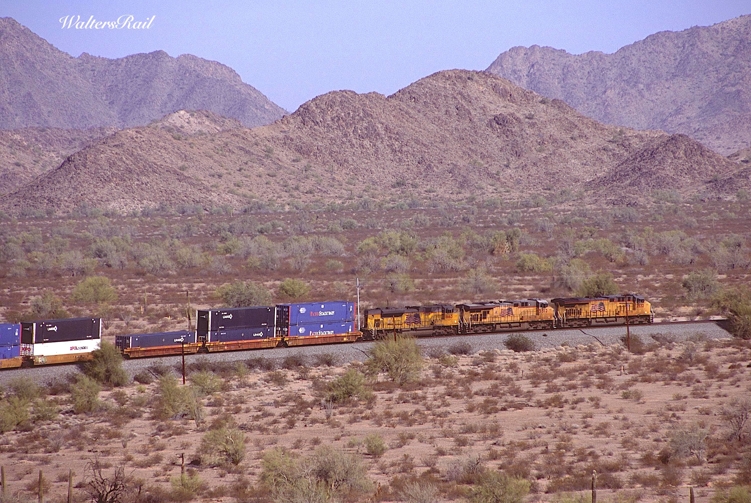
| Westbound UP stacks have crested the summit at Shawmut and are headed downgrade to the Gila River and Yuma. |
 |
| Deep in the Maricopa Mountains. |
The Maricopa Mountains of south central Arizona remind me of the Wichita Mountains of southwestern Oklahoma. Both are remnants of much larger chains worn down over eons to small protuberances from otherwise rocky soil, pimples on the face of an old man. Your author himself falls into the "senior citizen" category, and even he can hike to the top of these "peaks" without distress.
 |
| Wichita Mountains |
 |
| Maricopa Mountains |
But there is at least one huge difference. The Maricopa Mountains rise in the midst of the Sonoran Desert and are watched over in silence by majestic Saguaro cacti.
 |
| Saguaro |
Your first view of a Saguaro should leave you awestruck. Photographs do not do justice to these giants. Young Saguaro sprout single stalks rising from the desert like light houses. Older specimens grow arms. The Saguaro is to Arizona as the Redwood is to California.
This is harsh country -- dry, cloudless, radiating heat like a parking lot. Yet the sand is filled with vegetation, a seeming impossibility, mile upon mile of cacti, palo verde, mesquite, catclaw, creosote, desert willow, yucca and agave. There is just enough rain here to support this abundance -- an abundance which seeks yearly to consume the Union Pacific tracks climbing the grade to the Pacific or Texas, depending on direction.
The railroad through these mountains roughly follows one of the four routes selected by the federal government as potentials for the first transcontinental railroad. The political and commercial rivalries involved in merely choosing the routes were Sisyphean. Like feed lot cattle struggling at the trough, every state and territory west of the Mississippi River vied for consideration. So did various construction companies, each with visions of monumental wealth. Nothing like it would rise again until one hundred years later -- the construction of the interstate highway system.
In 1854, Congress included in the budget of the War Department a line item allowing Jefferson Davis (the Secretary of War and soon to be President of the Confederacy) to send survey parties across the West, searching for the perfect railroad route to the Pacific. When the dust settled, four routes were chosen:
1. A far northern route along the 47th to 49th parallels, following the Missouri River into Montana, then across the Rockies and Cascades to Puget Sound (more or less followed by the Northern Pacific, Great Northern and Milwaukee Road);
2. A north central route along the 37th to 39th parallels, across Kansas, the Rockies and Wasatch to Salt Lake City, then across the Great Salt Desert and Nevada to the Sierra Nevada, then to the Pacific (sort of followed by the Union Pacific, Denver and Rio Grande Western and Western Pacific);
3. A south central route along the 35th parallel, from Fort Smith, Arkansas, across Indian Country to Texas, New Mexico, Arizona and the Mojave Desert (eventually partially followed by the Santa Fe but only from central New Mexico westward);
4. A far southern route along the 32nd parallel from Texas to the very southern reaches of California (kind of followed by the Southern Pacific).
 | ||
|
 | ||
|
We are here concerned with geography along the 32nd parallel, what SP came to call the Sunset Route. A portion of the survey -- from Yuma, Arizona, across the recently acquired territory of the Gadsden purchase in Arizona and New Mexico to the Rio Grande -- was led by John G. Parke.
 |
| John Grubb Parke |
In the War Between the States, he served as Chief of Staff to Ambrose E. Burnside at Antietam, Fredericksburg and the Overland Campaign. He also held significant field commands during Burnside's North Carolina Expedition, Vicksburg and the battle of Fort Stedman, plus brief stints in command of the Army of the Potomac.
He filed a detailed report to Congress concerning the 32nd Parallel survey, which today can be found at:
https://quod.lib.umich.edu/cgi/t/text/text-idx?c=moa&idno=AFK4383.0002.006.
From Yuma, Arizona, the survey party followed the Gila River northwest to Gila Bend, where the river turned north, while the survey team turned east and began its climb to the summit of the Maricopa Mountains at Shawmut. Given the mountains' diminutive size, it is not surprising that Parke's report only mentions them in passing:
"February 16, 1854 -- On turning from the river we have to encounter a long stretch of about seventy miles where the finding of water is very uncertain, it being dependent upon the rains and seasons. . . . We started from camp, on the left bank of the Gila, about six miles above the Pimas, at 1 p.m., and after traveling 3.5 miles in the river-bottom, took a course tangent to the eastern base of the ridge on our right, and skirting a mesquite growth, interspersed with small patches of bunch-grass, extending southeastward from the Gila. As we progressed the road became hard and firm, leading over a gradually ascending plain of red gravelly surface, destitute of all vegetation except the grease-wood and occasional mesquite. In the distance, on the right were low mountains, and on the left a low ridge, increasing in altitude towards the south."
 |
| Eastbound UP stacks are climbing the "gradually ascending plain" out of the valley of the Gila River -- as described by Parke. |
 |
| More UP stacks ascending between "low mountains and . . . a low ridge." |
 |
| Looking west toward Gila Bend at the "gradually ascending plain." |
Comparing these images to Parke's description, one is immediately struck by the claim that the area was "destitute of all vegetation except the grease-wood and occasional mesquite." The photos show massive plant life. Most surprising, Parke makes no mention of the Saguaro. These majestic cacti can live 150-200 years. It seems unlikely that none were growing when the survey team came through.
In another section of his report, however, Parke gives a general description of the terrain and vegetation, bearing closer resemblance to images taken by your author:
"The soil of this plain changes from a dry, ashen loam at the Gila, through a reddish argillaceous sand, to a gravel as we approached the ridges and peaks; and yields a growth of stinted artemisia and larrea, with mesquite in the low portions, and cereus giganteus, midst other varieties of the cacti, upon the uplands.""These mountains are of peculiar form and shape," wrote Clarke. "Their serrated crests and faces, often vertical and cliff-like, surmounting the slopes of the debris, gives the whole, particularly when aided by mirage, a semblance to the crumbling towers of a fallen castle."
 |
| With a lash-up including the Olympic Torch Relay Unit, westbound stacks pass "the crumbling towers of a fallen castle." |
 |
| Westbound grain. |
 |
| Eastbound nearing the summit. |
 |
| Andrew B. Gray |
A second survey along the 32nd parallel was carried out privately by Andrew B. Gray on behalf of the Texas Western Railroad. Gray was born in Norfolk, Virginia, began surveying as a teenager and participated in the survey of the Mississippi River delta. After a short stint in the Texas Navy, when Texas considered itself an independent republic (an attitude little changed in the 21st century), he surveyed the boundary between the United States and the Republic of Texas. (Your author, who was born and has lived almost his whole life in Oklahoma, knows exactly how Canadians feel, because Oklahoma is to Texas as Canada is to the United States. Both Canada and Oklahoma are constantly vexed to grief by a lumbering giant to the south.)
Gray spent the Mexican War in North Texas and was appointed the principal surveyor of the United States-Mexican border after the Treaty of Guadalupe Hidalgo in 1848. In 1853 he was hired by the Texas Western Railroad to locate the most propitious route from the Rio Grande to southern California. In places, he deviated significantly from Parke's earlier survey; however, he chose the identical route through the Maricopa Mountains.
Gray entered the Confederate Army in 1861 as a captain. On April 16, 1862, while conducting a survey for Gen. P. G. T. Beauregard, Gray was killed at Fort Pillow.
 |
| Eastbound UP stacks through the route surveyed by both Parke and Gray. |
 |
| Westbound. |
The Texas Western Railroad never built west to California; however, the 32nd parallel route quickly became a major gateway. Stage coach lines appeared like locusts. The first began in 1857. Called the "Jackass Mail," the San Antonio and San Diego Stage Company carried passengers and correspondence sporadically for about a year. Then followed the Butterfield Overland Mail, the first dependable transcontinental stage line. Beginning September 18, 1858, the Overland Mail ran from Tipton, Missouri, to San Francisco, following the 32nd parallel route through Tucson, the Maricopa Mountains, Gila Bend and Yuma. For reasons unknown to this author, the stage route did not pass the summit of the Maricopas at Shawmut, instead crossing the mountains to the north at Butterfield Pass. Besides Butterfield Pass and a few other exceptions, the stage coaches followed the route later constructed by the Southern Pacific. Many SP stations, in fact, were originally stage stops. Outbreak of the War Between the States forced Butterfield to move north; it never reopened the southern route.
That chore belonged to the Southern Pacific, a company operated by the Central Pacific to protect its monopoly in California. The "Big Four" of Collis Huntington, Charles Crocker, Mark Hopkins and Leland Stanford had controlled the Central Pacific's portion of the first transcontinental railroad, establishing a California empire. If you don't believe your author -- a graduate of Stanford University -- take a cable car to the top of Knob Hill in San Francisco and eat a scrumptious meal in the Big Four Restaurant in the Huntington Hotel, then spend the night at the Top of the Mark in the Mark Hopkins Hotel. Until the mid-1980's, you could have deposited your money in the Crocker Bank, now owned by Wells Fargo.
The Southern Pacific was originally created to build a railroad from San Francisco to Los Angeles, then east to the Colorado River on the border with Arizona. Realizing the value of such a route, the Big Four acquired a controlling interest. When the Texas and Pacific Railroad was chartered in 1871, Congress gave it land grants and authority to connect with the Southern Pacific at Yuma, Arizona. The SP was not to cross the Colorado River.
The rail link from San Francisco to Los Angeles, including the famous Tehachapi Loop, was completed when track layers met at Goshen Junction in September 1876. Then the SP began construction east out of Los Angeles, down the Imperial Valley toward Yuma. As the line neared the Colorado River, the Texas and Pacific had not yet reached Fort Worth.
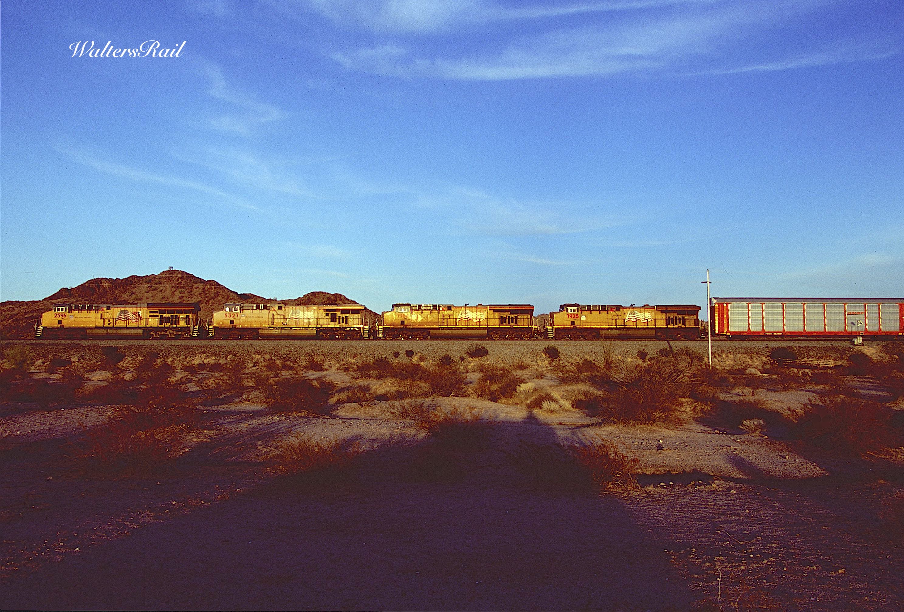 |
| Eastbound autos. |
 |
| Westbound to Yuma. |
 |
| More westbound stacks. |
Goods began rolling from San Francisco to Arizona and were ferried across the water. Bridge work commenced in 1877, and the Texas and Pacific quickly complained to Congress, which ordered the SP to stop construction. The railroad ignored the order, completed the bridge and entered Yuma September 30, 1877.
The Southern Pacific continued building eastward while seeking Congressional approval, not forthcoming, so the railroad turned to the territorial legislature of Arizona, which quickly consented. A new entity was formed -- Southern Pacific Railroad Company of Arizona -- with directors Charles F. Crocker, David D. Colton, A.P.K. Safford, Charles Hudson and David Neahr, all closely tied either to the Central Pacific or the Arizona legislature.
East from Yuma, the desert presented few obstacles. The land here is mostly flat, radiates heat like a magnifying glass and encouraged the railroad to push the Chinese labor force beyond human endurance. At Gila City a small dome of rocks required blasting a deep cut. Thereafter, track was laid at about one mile per day. By December 1878, the line had reached Adonde Wells, which for a brief moment became a bustling terminus settlement. Once the railroad moved on, however, Adonde Wells withered into the sand.
By April 1879, the tracks had reached Gila Bend, where construction followed the earlier surveys of Parke and Gray, climbing upgrade to Maricopa Summit, later called Shawmut, where the small mountain range was crossed.
 |
| Westbound BNSF power has crossed the summit, while silent Saguaro watch impassively. |
 |
| When UP acquired the SP in 1996, less than 25 percent of the Sunset Route was double-tracked. Since then, UP has double-tracked extensive stretches, though the one percent grade in both directions to Shawmut remains single track (as of the date of this article: August 2022). In steam days, the summit required pushers, and Shawmut developed a small settlement to handle the extra engines. All traces of those facilities are long gone, though one can still see evidence of the "Y" in the sand. As this image shows, the mainline was realigned around 1960. The old grade is in the foreground. |
 |
| Same train, showing more of the old alignment. The new mainline was designed to lessen the curves. |
 |
| More of the old grade, which is still in good enough condition that one can drive a Jeep on it. |
All four of the proposed routes authorized by Congress were surveyed carefully, but the intervention of the War Between the States postponed actual construction. Eventually, as we know, the government selected the north central route between the 37th and 39th parallels, and the rest, as they say, is history.
But when the surveys were completed, Jefferson Davis recommended to Congress that construction proceed along the 32nd. His report can be found here:
https://library.si.edu/digital-library/book/reportsofexplora11855unit
Over the years, the general consensus has been that Davis favored the southern route because he was a born and bred Southerner. The 32nd parallel, so the logic goes, would have provided a direct pipeline from the slave fields of the southeast to the wide open country of the southwest. Slave owners, so goes the narrative, grew dizzy with delight at the thought of growing cotton in the New Mexico and Arizona deserts, places with climates almost identical to Egypt, where the plant was first domesticated.
The standard narrative may, or may not, be true, but consider this. Political considerations aside, the best route for railroad construction was the 32nd. Across New Mexico, the terrain is as flat as a lake bed almost all the way to the Arizona border. The western continental divide is impossible to detect without elaborate equipment. The first obstacle is the short mountain pass at Steins. In Arizona the most difficult grade on the entire route is crossed at Dragoon. There is a small summit at Mescale, then Shawmut. In California, Beaumont Hill is the last obstacle to Los Angeles.
Although this list may sound imposing, it is minuscule compared to the barriers faced by the construction crews along the other three routes.
The 35th parallel across northern Arizona alone was a roller coster ride, one long grade after another in both directions. The climbs in both directions leading to the Arizona divide near Flagstaff were long and tortuous, and the tracks down the escarpment from Williams to Ash Fork were so difficult that the Santa Fe replaced them in the mid-twentieth century with the Crookton Cut-off. Plus, there were Raton, Glorietta and Cajon Passes, to say nothing of Ash and Goffs Hills and the other gradients in the Mojave.
The travails of the Overland Route are well known, particularly the ordeal of crossing the Sierra Nevada. And one need only read the journals of Lewis and Clark to appreciate the obstacles faced along the northern route in Montana and Washington. Also, both these routes were and are subject to massive winter snows, thus the need for sheds to protect the tracks.
Another way to put it is that there was no equivalent to the Donner Party along the 32nd parallel.
Here are Davis's words to Congress:
Among the considerations which determine the general position of the route near the 32d parallel, are the low elevation of the mountain passes in this latitude, and their favorable topographical features, as well as those of the table-lands, extending over more than 1,000 miles of the route; the favorable character of the surface generally, on the route, by which the most costly item of construction in railroads, the formation of the road-bed, is, in a great measure, avoided; the shortness of the line, 1,600 miles, from the navigable waters of the Mississippi to the Pacific, and the temperate climate on the elevated portions in this southern latitude.
 |
| In the 21st century, Union Pacific loves to run outlandishly long consists, generally two full lengths spliced together by mid-trains. Here are two in Run 8, grinding eastward toward the summit at Shawmut. |
 |
| CSX in the desert -- a long way from home. |
 |
| UP-CSX Combo |
 |
| Eastbound to Tucson. |
 |
| Also eastbound. The original alignment is just barely visible in the foreground. |
Davis's report to Congress very accurately, and objectively, described the difficulties of each of the four surveyed routes:
32nd Parallel -- [Discussing the crossing of New Mexico and eastern Arizona] "The great difficulty experienced in crossing this district is in the long distances over which no water is found at certain seasons. The survey by Lieut. Parke was made during the dryest [sic] season of the year, and, irrespective of the springs found at intermediate points, the whole distance tween the two rivers, Rio Grande and Gila, may be divided into five spaces, varying from 80 to 53 miles in length, at the termination of which large permanent supplies of water are found at the most unfavorable season of the year."
35th Parallel -- [Discussing the roller-coaster ride through northern Arizona] "The sum of the ascents from San Pedro to Fort Smith is 24,641 feet; of descents, 21,171 feet; equivalent, in the cost of work on the road, to an increased horizontal distance of 924.5 [miles], which added to the length of the line of location, 1,892 miles, gives for length of equated distance 2,816 miles."
37th to 39th Parallels -- [Discussing the crossing of the Continental Divide in Colorado] "The approach to the summit of the pass, 10,032 feet above the sea, 816 miles from Westport, is not favorable, the pass in this part having a defile character, overhung occasionally by walls of igneous rock. To cross the summit, a grade of 124 feet per mile for several miles, and a tunnel nearly two miles long, are required."
47th to 49th Parallels -- [Discussing political considerations of the day] "The severely-cold character of the climate throughout the whole route, except the portion west of the Cascade mountains, is one of its unfavorable features; and, for national considerations, its proximity to the dominions of a powerful foreign sovereignty [British Columbia and England] must be a serious objection to it as a military road."
 |
| A westbound manifest has just crested the summit at Shawmut. Immediately behind the train is Arizona Highway 238 -- West Maricopa Road. |
 |
| Westbound stacks curve through the Maricopa Mountains. |

 |
| The hottest train on the railroad. |
 |
| Approaching the summit. |
 |
| Eclectic eastbound. |
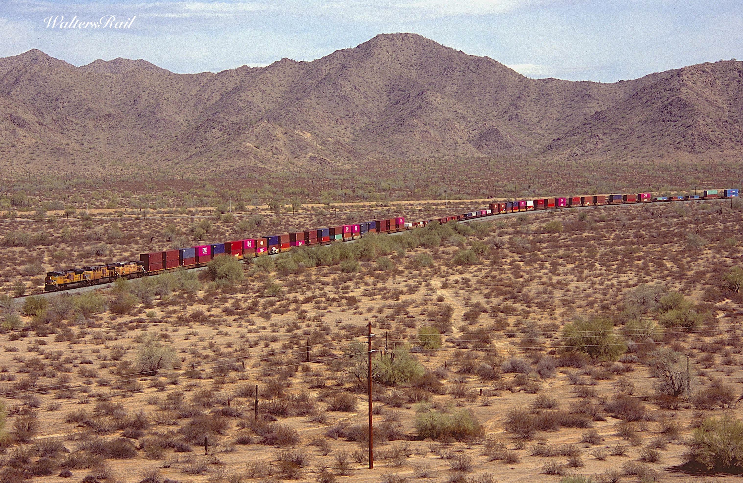
Arizona Highway 238 runs from Gila Bend to Shawmut, slowly climbing an almost imperceptible grade that nonetheless slows every eastbound to a crawl. If you are adventurous, you can follow two wheel ruts through the desert on the south side of the tracks, not a UP maintenance road, but a trail through the Sonoran Desert National Monument. The railroad runs in a straight line from southwest to northeast, climbing slowly, and you would think that the desert would reveal multiple locations for train photography, but you would be wrong. The desert plants are so thick that you can barely see the tracks.
The palo verde is abundant in the Sonoran Desert. Its trunk and branches are green and, unlike any other tree known to your author, can produce photosynthesis without leaves, which drop during long dry spells. Along the tracks, the palo verde is short, at most 20 feet tall, but abundant enough to obscure views of nearby trains. I have spent my entire adult life looking for railroad photography locations not blocked by trees, which is why almost everything I shoot is in the West. I never thought that foliage would be an issue in the desert.
%20copy.jpg) |
| Eastbound stacks have made the turn off the tangent track from Gila Bend are climbing the grade to Shawmut. This image shows the mile upon mile of palo verde lining the tracks, making ground level photography impossible. |
The Sonoran is different than the Mojave. In the latter, life feels tenuous, hanging by a thread, like an automobile teetering on the edge of a cliff. One second it might fall; another it might not. But sooner or later, you feel, it will meet its doom. It's just a matter of when.
In the Sonoran, by contrast, life seems ready to explode, like a colt standing up for the first time. The miles and miles of sand cannot obscure the miles and miles of plants. They fight a constant battle, sand and plant, but unlike the car on the cliff, you feel that the plants will somehow triumph in the end, that the sand will disappear and a new reality take its place.
This feeling is strongest in the 15 minutes or so before the sun sets. Then the light is warm; color returns to the desert after the bleaching of the day. You might even make a home here.
 |
| Reflection of late afternoon sunlight. |
 |
| Color returns to the desert . . . |
 |
| . . . as the sun sets. |
 |
| Last sunlight of the day. |
As mentioned, the line through Shawmut is single track, though on the east side of the summit, part of the old grade has been retained as a passing siding. When two trains meet, it appears that one has run aground and is following the nearby highway through the desert. Because the line is single track and trains struggle in both directions, the summit is a bottleneck; the passing siding is used often.
The following images show two "meets" that occurred within 30 minutes while your author and his faithful companion, Bear the Mighty Dog, were standing atop one of the small peaks, peering across the desert like two of Parke's original survey group. A westbound manifest held the siding while first an eastbound grainer and then eastbound stacks passed on the mainline.
 |
| Eastbound grain meets the westbound manifest. The westbound is on the passing siding, the original grade. |
 |
| The rear of the grainer has cleared the power of the manifest. The grainer is on the relocated mainline. |
 |
| The westbound manifest holds in the siding to meet eastbound stacks. |
 |
| The stacks have cleared, and the westbound begins to roll. |
East of Shawmut, the mountains open to a wide valley that slowly descends toward Maricopa, a town named after the Native American tribe that lives along the Gila River. For centuries, the Maricopa formed small groups by the Colorado River, but in the 16th century, they migrated to the Gila after attacks by the Quechan and Mojave.
In the 19th century, the Maricopa joined with the Pima and defeated the Quechan and Mojave at the Battle of Pima Butte near Maricopa Wells. In the 20th century, the Bureau of Indian Affairs forced the tribe to distribute communal land into individual allotments, along the lines of the infamous Dawes Act that was applied to the Five Civilized Tribes in Oklahoma. Individual tract farming, however, was wholly unsuited to the desert, and crop production withered. According to the most recent census, the tribe's population is approximately 800. Water flow in the Gila has been reduced to almost nothing. Today the Maricopa farm with well water -- with mixed results.
This dry recitation does not do justice to the tribe, which today somehow manages to keep to itself despite the vast urban Phoenix sprawl. One advantage is that tribal land is off limits to development and still retains its natural character. As one drives south out of Phoenix, urban America stops suddenly at the border with tribal lands. Your author is uncertain which lands belong to which tribe, but the transition is as sudden as walking from the shade into the sunlight. All one can say it, "Thank God for tribal lands."
 |
| Westbound stacks are crossing the valley between Maricopa and Shawmut. |
 |
| More westbound stacks. This valley is part of the Sonoran Desert National Monument and also off-limits to development. |
 |
| Another westbound stack train in the valley. |
The town of Maricopa has had three different locations over the years. The first was Maricopa Wells on the south bank of the Gila, an oasis for 19th century immigrants traversing Arizona to reach the California gold fields. Both the San Antonio and San Diego and Butterfield Overland Mail stage coach lines stopped there.
In 1879, the railroad came through, and the town moved the telegraph office and post office eight miles south to the tracks. This location soon became known as Maricopaville and was filled with hotels, saloons, brothels and warehouses.
A few years later came the construction of the Maricopa and Phoenix railroad, and the town moved three miles east. After 40 years of flooding on the Gila River, the Southern Pacific built a new line from Picacho to Phoenix, and Maricopa lost its status as a junction.
First incorporated in 2003 with a population of 1040, Maricopa's population by 2010 was 15,934. In 2020 the population was estimated at over 60,000. In that same year, the Census Bureau pegged the population of metropolitan Phoenix at over 4,800,000.
Your author is amazed that the desert can support such numbers and wonders if there is a limit. Over a century ago, John Wesley Powell warned about the fickleness of the American West: "Years of drought and famine come and years of flood and famine come, and the climate is not changed with dance, libation or prayer."
 |
| Sometimes the intermodal trains have rear DPUs. Here one is pushing west after clearing the summit. |
 |
| Another westbound pusher. |
 |
| With leafless palo verde in the foreground, Kansas City Southern assists a westbound manifest. |
 |
| Traveling west. |
 |
| In the broad valley, climbing the grade west to the summit at Shawmut. |
 |
| Trains passing east of Shawmut. |
The report of Jefferson Davis to Congress concludes with a last argument in favor of the 32nd parallel route:
"A comparison of the results stated above, and of those exhibited in the tables referred to, conclusively shows that the route of the 32nd parallel is, of those surveyed, the most practicable and economical route for a railroad from the Mississippi river to the Pacific ocean.
This is the shortest route; and not only is its estimated cost less by a third than that of any other of the lines, but the character of the work required is such that it could be executed in a vastly shorter period. It is obvious that a road on any of these routes, with the exception perhaps of the 47th parallel, must be built continuously from the two extremities, and an obstacle that arrests its progress at any point defers the commencement of all the work in advance. The tunnels and much of the other work on the more northerly routes in the most desolate regions are such as could not be commenced until a road was constructed up to those points, and would then require a long period for their completion.
On the southernmost route, on the contrary, the progress of the work will be regulated chiefly by the speed with which cross-ties and rails can be delivered and laid, the nature of the country being such that throughout the whole line the road-bed can easily be prepared in advance of the superstructure. The few difficult points, such as the Pass of the Guadalupe and Hucco mountains [in far west Texas], and the passes between the Rio Grande and Gila [including Shawmut], would delay the work by an inconsiderable period.
Of course, at the conclusion of the War Between the States, Congress chose the Overland Route, along the 35th to 37th parallels, which bypassed the Rocky Mountains of Colorado by climbing the relatively benign "gangplank" of southern Wyoming -- across Sherman Hill onto the Laramie Plains. Although this line was no picnic in the winter, and although the Wasatch and Sierra Nevada lay ahead to the west, the Overland Route was probably a better choice than the paths later followed by the Northern Pacific, Great Northern and Milwaukee road, because the snows along the 47th to 49th parallels were as bad or worse than anything along the Overland Route, plus the territory in the far north was even more isolated and also significantly closer to the remaining British Empire in North America -- a significant political concern in the 19th century.
Although the 32nd and 35th parallel routes both received significantly less snowfall (the 32nd receiving virtually none, while snow on the 35th was a serious concern only around Flagstaff), and although both routes did not involve crossing the Rockies, Cascades or Sierras, neither was ever seriously in the running, because after the War, the South, never an industrial powerhouse, was devastated. A railroad line from Arkansas and Indian Country to the Pacific would have served no purpose. The same was true for a line from Texas to Los Angeles. After the War, the largest city in Texas was Galveston, with a population of less than 10,000. Congress would not have selected the first transcontinental railroad to connect the defeated South with anywhere.
 |
| The heart of the Sonoran Desert. |
 |
| Downgrade to Yuma. |
 |
| Led by Heritage unit 1111, the SD70ACe "Employee Pride," westbound stacks are at the Shawmut summit. |
 |
| East to Maricopa. |
“He'd always had a quickening of the heart when he crossed into Arizona and beheld the cactus country. This was as the desert should be, this was the desert of the picture books, with the land unrolled to the farthest distant horizon hills, with saguaro standing sentinel in their strange chessboard pattern, towering supinely above the fans of ocotillo and brushy mesquite.” Dorothy B. Hughes, The Expendable Man.
Once in your blood, the desert is yours forever. Take good care of it.
To see my other posts, go to waltersrail.com.
To see my photographs on Flickr, go to https://www.flickr.com/photos/jpwalters/.
GREETINGS FROM MARICOPA ARIZONA,
ReplyDeleteI RECENTLY FOUND YOUR PHOTO ESSAY AND COMMENTARY ON UP THROUGH THE MARICOPA MOUNTAINS.
YOUR PHOTOS ARE VERY WELL DONE I THINK.
HOWEVER YOUR NARRATIVE IS SOMEWHAT INCORRECT CONCERNING THE SHAWMUT AREA.
AS BUILT THE SP/UP LINE FOLLOWS MORE CLOSELY THE 33RD PARALLEL THROUGH THE MARICOPA MOUNTAINS.
THE 32ND PARALLEL CROSSES SOUTH OF TUCSON AZ.
THE OTHER ISSUE IS THAT THE GRADE CREST BOTH EAST AND WEST SUMMITS AT ESTELLA AND NOT SHAWMUT.
OVER ALL WELL DONE
BEST REGARDS
MEL S.